|

View from my tent shortly after sunrise |
|
The sky was
overcast with a little drizzle as I set off but the drizzle didn’t
last long. I rode along the path back to the road then rejoined the
A1086. Considering I’m near to the coast the hills are long and some
quite steep. To the east of Peterlee I took a wrong turning and
finished up climbing a very steep hill only to find the road had
been blocked to through traffic. |
|

Wide view of the Wearmouth Rail Bridge which spans the River Wear.
The iron box girder construction was opened in 1879 |
|
I just wheeled the
bike round the bollards and continued to find my way back to the
original route. The map shows many places with the name Colliery
attached but I didn’t see any signs of working mines. I kept off the
main roads wherever possible and took a minor road towards the coast
to Seaham. It was an impressive seafront with hotels, large houses
and a nice road along the prom. I continued north to Sunderland and
came to an impressive old girder bridge which wasn’t on my original
route plan. It had the rail bridge running parallel so I decided to
use it. I soon regained my planned route and carried on to Whitburn. |
|
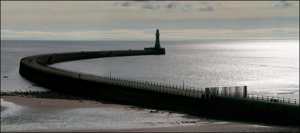
Roker Pier, Sunderland |
|
The weather continued to improve. I
noticed a Morrisons store and decided to buy some water while I had
a chance. I got the same as yesterday, a 5lt bottle for £1.10. My
plan is to catch the train home from Newcastle tomorrow so today I
only need to get within striking distance of the railway station.
The map shows 2 possible places to camp and both aren’t far away.
The first is at Lizard Point only a few miles up the coast. I set
off but soon had to stop to check out a lovely windmill up to my
left. It was set in a mown grassy area and was a picture postcard
view. The information board said it dated back to 1790 but the
structure today had been extensively reconstructed after the
original building deteriorated to nothing more than a stonework
shell. |
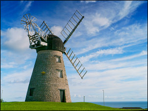
Whitburn Windmill |
|
I carried on until I came to the
Souter Lighthouse which also indicated the location of The Lizard
Point. I wheeled the bike down to the cliff edge, looking for
somewhere to camp. There were many warning signs but the problem was
too many thistles! The area around the lighthouse was pleasant mown
grass. An information board told me that it used to be the thriving
village of Marsden that existed for the adjacent coal mines. All now
long gone. There were many people out enjoying the sunshine. Back
towards the road was a small grassy hill. I had a look and found a
flat spot that would be big enough for my tent. I managed to remove
the few thistles that were in the way. Being above the main paths
there were few people came this way. The views were excellent.
Although the lighthouse is no longer used I was surprised when the
fog horn was sounded even though there was no fog. |
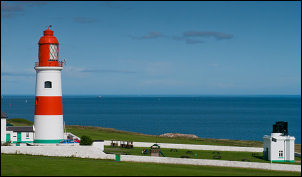
Souter Lighthouse with the foghorn to
the right |
|
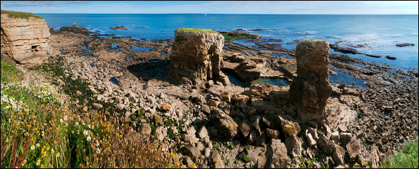
Coast at Lizard Point |
|
|