|
The wind reduced during the night but
the snow returned. This is my last day but at least I don’t have to
rush to catch a bus. It was still very thick mist and as I started
to pack the tent away just before 8am the wind began to pick up.
Packing the tent took much longer than usual because of the snow. I
had to dig down along the guy lines to find the pegs which mean that
each had to be individually dug out. There was probably over a kg of
snow and ice still attached to the tent when I packed it away. I set
off to find the main path down from Codale Head towards Stickle
Tarn. It was a total whiteout and very difficult to keep on track,
though no track was visible. I hadn’t been going long when I sank
through the snow into a shallow tarn underneath. |
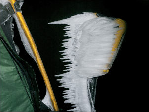
Even more snow and ice on my ice axe |
|

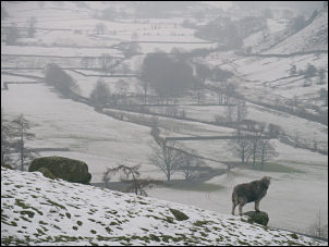
All I could see of Stickle Tarn |
I was up to my knees in freezing
water and my warm dry socks were now awash in freezing water. This
wasn’t good as I have a long way to walk back to Coniston. With a
full covering of snow there was no sign of the path. Occasionally
I’d come across boot prints in the snow but they didn’t help as the
paths in the area head for various descent routes. My first
objective was Stickle Tarn because from there the path down is very
distinctive and well used. Even in good weather the rout finding
isn’t easy as the approach to Blea Rigg has at least 3 paths
radiating from it. I continued down and was amazed how thick the
mist continued to be. When I eventually reached Stickle Tarn I still
couldn’t see anything. |
|
I reached the main path down and
started to descent. It had quite a bit of snow on it and was very
steep in places. As I got lower I started to meet people coming up.
Most were reasonably equipped but some weren’t and probably had no
idea of the difficult conditions they were climbing into.
Approaching the old footbridge over Stickle Ghyll I descended below
the cloud and could see a dismal Langdale Valley with a sprinkling
of snow. I turned right on to the B5343 road and headed up the
valley. There were plenty of parked cars about and a few walkers. |
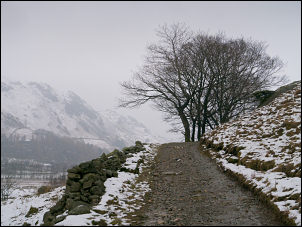
Wintery Langdale. |
|
The track to Tilberthwaite. |
The rest of my route was now on roads
and old tracks so the going would be much easier. Approaching the
steep road up to Blea Tarn some cars were turning round and heading
down, having decided it may not be wise to try and get up in the
snow. There wasn’t much snow on the road but I still had to be
careful in case of ice. It was pleasant walking and with the fells
being covered in thick cloud it looked like most people were just
enjoying walking along the road. |
|
There was little traffic to get in the
way. At the next junction I turned right then left over Fell Foot
Bridge. The track to Bridge End cottage had a lot of walkers on it
and also the continuing track towards High Hall Garth. I took the
right branch and headed south to High Tilberthwaite. I joined the
tarmac and continued to Low Tilberthwaite. There were a huge number
of cars parked in the car park at the base of Tilberthwaite Gill. I
kept to the road and followed it to the main A593. I was a bit
concerned about walking along the road on a busy Sunday but was
delighted to see a path heading off though the woods. |
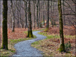
Path through the trees to Coniston. |
|
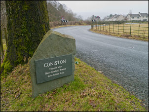
Reaching Coniston. |
The path is to get pedestrians off the
road all the way to Coniston. It was well made and a delight to walk
on. I reached Coniston about 13:35. If I’d been using public
transport to get home it would have taken 3 busses and 2 trains.
With my car waiting I had an easy drive and was home by mid
afternoon. |
|
|