|
I set off at 6:45am
and drove via M6, M74, Erskin Bridge, Tarbet to Inveraray where I
stopped briefly to photograph the town across the bay. The A819
right turn in the town is interesting because it goes through a
stone arch and at first appears to be the entrance to some grand
property. I continued to the A85 to near Dalmally. Cloud and heavy
rain didn't improve my expectations of a good walk. I turned left
and followed the road to the Cruachan Power Station car park. I had
a quick look in the visitor centre but the tour was £5 and I didn't
have time to go on it anyway. My objective was to climb Ben Cruachan
if the weather is suitable. The website walkhighlands.co.uk had a
very good guide to the walk and I followed its recomendations to
park near the railway station. The path it describes isn't shown on
the OS map and I'd never have found a better way up to the Cruachan
Reservoir. |
|
Inverary from the River Aray |
|
The path firstly heads towards the
tiny railway station platform then ducks under a small underpass
then up a narrow muddy path climbing steeply up to the Reservoir
access road. A path and metal ladder then continues to the top of
the dam. The overcast weather had now turned to rain and by the time
I'd reached the western end of the dam the rain was torrential. I
followed a track along the west shore of the reservoir and stopped
briefly to look at one of 3 tunnels emerging from the mountainside. |
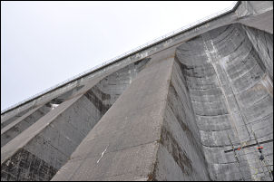
Cruachan Dam |
|
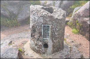
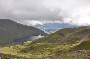
Ben Cruachan summit trig point |
Water was gushing
from this one into the reservoir and it looks as though the tunnels
bring water from the other side of the mountain. At the head of the
reservoir, where the track stops, I turned left up Coire Dearg. It
was wet underfoot at first then got steeper as I climbed to the top
of the pass. The weather continued bad with rain and cloud. There
was hardly any wind so I decided to continue. I came to a small
lochain mentioned in the notes and turned right. The indistinct path
wound through boulders and the rain continued. I had no visibility
but still there was no wind so I pressed on. |
|
Eventually I reached the small summit
cairn and damaged cylindrical trig point on the summit at 1127m. It
was still cloudy but the rain had stopped. It felt brighter and
above I briefly saw some blue sky, but it soon vanished. I set off
east along the misty ridge. With little visibility it was quite
imposing. I could see a sheer drop down to my left and had no idea
what lay ahead. I picked my way down carefully until I came to a
slab mentioned in the notes. |
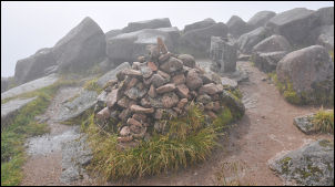
Ben Cruachan summit
|
|
Cruachan Reservoir |
I took the
recommended descent to bypass it but as I descended the weather
cleared enough to reveal the valley below and the path I'd used to
climb the mountain. I decided to continue my descent as continuing
along the ridge didn't make sense in the cloudy conditions. It was
steep for most of the way until I reached the path then it just
became slippery and muddy. Eventually I got back on the reservoir
track and followed it to the embankment. I walked the full length of
the dam this time then down the track to the muddy path descending
back to the railway station. |
|
I reached my car about 17:45 as the
clouds began to clear and the sun came out. I drove west along the
A85, through the Pass of Brander, to Connel where I stopped for a
while in the sunshine and watch the tide running under the bridge.
|
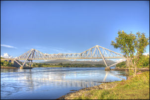
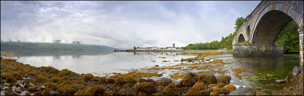
Connel Bridge |
|
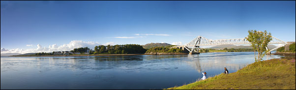
wide view of the Connel Bridge |
|
I continued north on the A828 to
Castle Stalker Appin where I stopped again, this time to photograph
the very picturesque castle. I continued to Ballachulish and drove
along the south side of Lock Leven to a lay-by near Kinlochleven
where I stopped for the night. |

Castle Stalker Appin |