|
I set off in the car around 06:40am to
drive to Fort William in Scotland. I headed north along the M6,
passing Carlisle, then in to Scotland to pick up the M74. I was
using my TomTom SatNav to find a route and I was expecting to go
over the Erskine Bridge and along Loch Lomond. Approaching Glasgow
the M8 signs seemed to peter out so I stayed with the GPS advice. It
took me via Stirling, which wasn’t a route I’d expected. Looking at
the map later it made some since. I’ve not driven on these roads for
many years so it was nice to be re-acquainted with them. Along the
A84 and through Callander there were many cyclists and I wasn’t sure
of the attraction for them. This is the area of the Trossachs so
that could be it. The road was relatively quiet and I followed it to
Crianlarich then on to Tyndrum. |
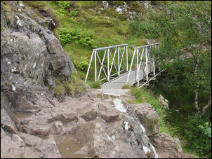
Footbridge on the climb of Ben Nevis |
|
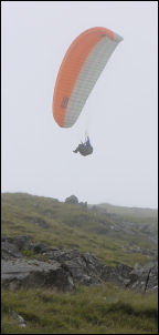
A hang glider in the low visibility |
The weather was now
deteriorating and following the A82 to Glen Coe the rain and cloud
made sure I didn’t see any of the magnificent views. Coming to the
bottom of the Glen I saw the turn off to the Clachaig Inn which I’d
visited on previous occasions. I was surprised how low the clouds
now was and driving along Loch Linnhe I could hardly see anything.
In Fort William I took the Glen Nevis Road and drove to the first
main car park. I arrived at 12:20pm and paid the £3 charge. I set
off at 12:45 to climb Ben Nevis. |
|
A footbridge took me over the River
Nevis where I followed a riverside path to join the main path up
from Achintee House. There was low cloud and drizzle when I set off
but the light rain stopped after a while as I continued up the path.
There were quite a lot of walkers on the path, some going up and
some down but none were what I’d call serious walkers. I was soon in
the cloud and heading up with little visibility. The last time I
came this way was when I’d just completed the West Highland Way walk
from Glasgow and had left my ruck sack at the road to do a quick
walk up Ben Nevis. |
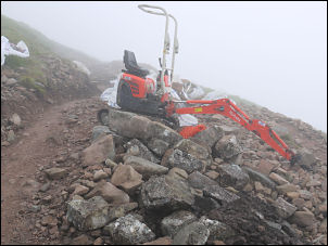
Rebuilding the path on Ben Nevis |
|
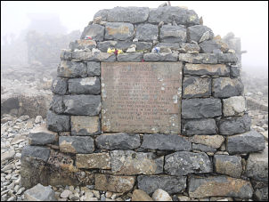
Memorial on Ben Nevis |
I reached the area
of the Loch which the map calls Lochan Meall an t Suidhe but there
was no sign of it in the mist. The path was very good and a lot of
work has been done to it since the last time I was here. For a long
time I climbed up on the main tourist path. Some men were working on
the path and I took a few photos before carrying on. The weather was
fairly calm and I managed to reach the summit by 15:05pm to find
many people already there. I took some photos and looked inside the
emergency shelter before starting the search for the reason for my
climb. The map shows a spring nearby and I set off to find it. |
|
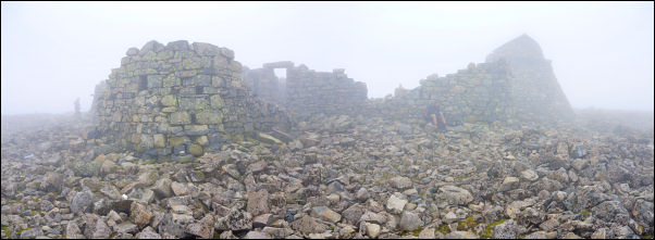
the Ben Nevis Observatory ruins this afternoon |
|
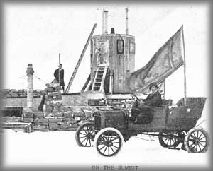
in 1911 a Model T Ford was driven
to the summit of Ben Nevis |
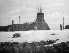
the Ben Nevis Observatory about
1900 |
|
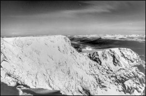
A time exposure night view on
the summit of Ben Nevis in 1981 |
When I found it I
was surprised how small it was. A nearby wooden storage cystern must
date back to the summit Observatory times. I’d just been walking
through the ruins. I set off down at 16:00 with the intention of
just reversing my rout. On the way down I stopped to talk to the men
rebuilding the path and also to a young man called Steve who was
heading up with his tent and food supplies to camp on the summit. I
wished him well and continued down in heavy rain to get back to the
car at 18:20pm. In Fort William I filled up with diesel then drove
via Spien Bridge, A82, Invergarry, A87 to a lay-bye overlooking Loch
Cluannie where I stopped for the night. I had a tent but decided to
sleep in the car for convenience. |
|
|
 Return to
Whittle Wanderer
Return to
Whittle Wanderer