|
It was a calm night and thankfully no
rain. A little sun shone at first light but it soon vanished to be
replaced with cloud. I’d still not decided on my route today as it
would depend on the weather. I didn’t delay after getting up and was
packed up and on the road by 06:45am. I only had just over a mile to
go before joining the A876. Just before the junction I noticed a
large rock to the left with a plaque on it. It was to commemorate
the opening of the road I’d just cycled along. It was completed in
1970 and opened by Princess Margaret the Countess of Snowden.
Presumably prior to that the small groups of houses along Loch
Torridon were serviced from the sea. |
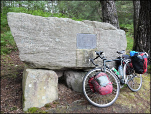
1970 memorial to the opening of the road |
|
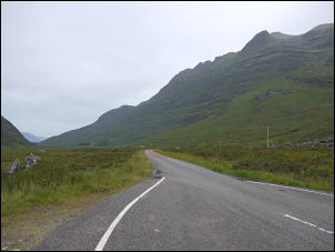
Gloomy Glen Torridon |
I turned left
passed Shieldaig but as it down its own branch road I didn’t see the
actual village itself. The road continued along the south side of
Upper Loch Torridon and although it was wider than the last road it
still had several steep climbs on its way to Torridon. There were
few vehicles out and the first person I saw was a young woman riding
a bike the opposite way. It’s not a village in the true sense as
there’s no centre, just a few small houses spread out along the
road. The last time I was here was in May 1984 while walking from
Achnashellach Railway station to Poolewe and Loch Maree. The
spectacular profile of Liathach rose in the distance like a hugh
hump-back whale. I stayed on the A896 to head up Glen Torridon and
the bleak views of sunless mountains both sides. |
|
The A road had now deteriorated to a
single track road with passing places and as I climbed steadily I
was riding into an increasing head wind. It was heavily overcast but
the cloud hadn’t obscured the summits. Beinn Eighe was the next
mountain to appear on the left. I though back many years when I
climbed it in winter snows. I checked my diary to find it was
January 1984. I remember my camp on the far side being extremely
cold. Over the summit I started the descent and at the same time the
rain started, gentle at first but getting heavier as I descended. I
reached Kinlochewe and hoped to find a cafe where I could get
something to eat. I saw 3 and they were all closed. A small shop was
attached to the garage and thankfully it was open. I bought some
chocolate and peanuts from the lady and as I paid she apologised for
the rain. |
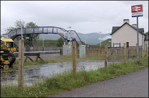
A very wet Achnasheen Railway Station |
|
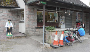
Stopping for a bacon and cheese roll.
A lifelike wooden assistant was sitting outside. |
It was raining
quite heavy so I changed to shorts and put my waterproof top on. I
decided to head for Inverness so turned right along the A832. It was
a long steady climb for several miles, still into the wind and rain.
It was quite bleak over the top and no houses anywhere. As I
approached Achnasheen I reckoned there must be a cafe as there was a
railway station. The station was off down a minor road and as I’d
hoped there was a cafe. There was; but it was shut! I pressed on
heading east. Since Kinlochewe the road had been exceptionally good
and wide and there was little traffic on it to cause me any
problems. When I got to the main A835 I turned right. The signpost
said Inverness 25 miles and at first I wasn’t sure whether to stay
on the main road or go the scenic route via Muir of Ord. |
|
My decision was soon made when I
realised I was riding on a road that drivers thought was a motorway.
I didn’t leave it just yet. On my right a heavenly apparition came
in to view. A transport cafe. I stopped and had a delicious hot
bacon & cheese roll for just £2.10, which I though was very
reasonable. The woman serving was very helpful and as the rain had
almost stopped I took the rain covers off my front panniers. One had
a hole in it, which I investigated. She’d spotted it as well and
before I’d said anything she’d handed me some duck tape and scissors
to fix it. |
|
After the repair I
was on my way and turned off the busy road on to the A832 into
Marybank. A tight left took me on Muir of Ord. Before I got there a
wonderful smell wafted across the road coming from a large building
on the right. It was Glen Ord distillery and as they had an
information centre I turned off to investigate. It was very well
laid out and a conducted tour of the distillery was underway. I
would have loved to stay longer but still had many miles to go.
Reluctantly I left, even without a sip of the single malt samples on
offer. I continued through Beauly then on the A862 towards
Inverness. When the main Firth came in to view I had a nice distant
view of the long span bridge carrying the A9 in to the town I’d
taken the scenic and slightly longer route but I was glad I did.
Even if it was just for the wonderful smell of the distillery.
Riding in to Inverness I looked everywhere for a sign pointing to
the A862 but could see no sign. I continued till I felt sure I’d
gone too far and asked a woman in a filling station. |
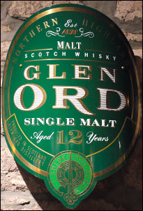
Glen Ord single malt |
|
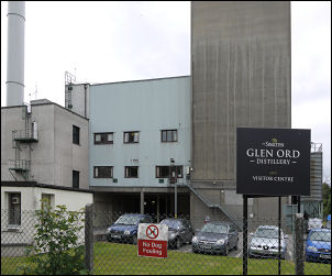
Glen Ord Distillery |
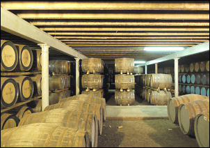
Whisky galore |
She told me to go back the way I’d
come and look for the Dores sign, which I did. I was soon on the
correct road heading towards the SE side of Loch Ness. I’d almost
covered 80miles so decided that after Dores I’d look for somewhere
to camp. Dores had no shops in it so pressed on along the B852. It
was shrouded in trees both sides with no views of the Loch. The rain
had started again and soon became quite heavy. There were dense
woods to the left and I noticed a nice clear spring issuing water
directly out of the mountainside. As I stopped to investigate the
rain became torrential so I wheeled the bike into the woods and
looked for an emergency pitch. I wasn’t ideal but any port in a
storm. The spring turned out to be crystal clear though the camp was
damp. There were no midges but plenty of larger flies around the
tent to annoy. The large scale map calls the spring ‘General Wade’s
Well’
|
|
|
 Return to
Whittle Wanderer
Return to
Whittle Wanderer