|
Caught the 6am bus to Preston then
walked to the Railway Station to catch the 06:54am York train to
Halifax. I bought a £10.55 return train ticket as I’m hoping to use
it on the way back. The train was quite full when I arrived at 08:05
and I followed the rushing commuters up the steps to the cobbled
Horton St. It was dull, cold and overcast. My plan was to catch the
522 bus from King Edward St to Illingworth to the north. I walked up
Horton Street and was immediately struck by the dismal frontages and
some empty and partially derelict buildings. Some of the pavements
hadn’t been cleared of snow and it had now turned to glass ice and I
had to either cross the road or walk in the road. I found an
information board which showed me where the public toilets were.
When I reached them they were pay for entry (20p) but that didn’t
matter as they were out of action and closed. |
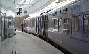
Halifax Railway station. |
|
My plan was to
wander round for a while and have a look at the town but there
didn’t seem to be much to see so I wandered in to the indoor market
where stalls were setting up. It was also warmer than outside. I ate
my sandwiches and hung around for a while before catching the bus
just after 9:30. By 10 o’clock I was at the Natty Ln turn off the
main Keighley Road. This was the start of my walk. I headed north to
where the Calderdale Way path route crosses the A629. I turned left
and followed the road past the Zion Church and down to the next road
junction. I turned right down the lane which was covered in frozen
snow and quite difficult to negotiate on foot so I don’t know how
motorists would cope. The lane reduced to a minor private track by
the time it had reached Stod Fold. |
|
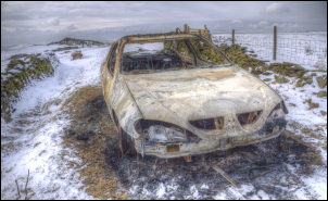
Derelict car near Hunter Hill. |
The way on wasn’t
obvious but one of the locals was there and he pointed me in the
right direction. The next two fields had a covering of snow but the
path was well trampled and the ground frozen hard. Ahead was Hunter
Hill and a steep slippery path took me up to a walled track near the
summit. The path split and footprints went both ways. I couldn’t see
any way markers so turned left, which was the wrong way. I soon
found myself on a long straight track between stone walls. It didn’t
match with the map. Before long I realised my mistake but didn’t
need to retrace my steps as I could still reach today’s objective by
another route. |
|
The track split and
I took the steep descent down to the road. Continuing downhill for a
while I turned right towards Stone Farm to try and find one of the
two paths shown on the map. Neither was marked on the ground and I
found the second but it seemed to have been blocked off lower down.
I reached the road above Wainstalls and turned right to follow the
road for a while till my route left it for a minor track leading
down to Upper Saltonstall. The icy track made the descent difficult
in places. I reached the road and crossed over to continue the
descent along an old path taking a less steep diagonal route down
the hillside to the woods. Then I dropped directly down to Luddenden
Brook and crossed at the large Wade Bridge. |
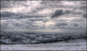
Interesting Sky above Mixenden. |
|
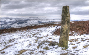
Crow Hill Nook with Stoodley Pike in the distance. |
I turned right to
follow a minor path up through the woods to reach Jerusalem Lane. I
turned right for a while then sharp left to reach Clough Cottage. I
was now on the edge of Midgley Moor and wanted to reach the moor top
at the first suitable path. I continued along the track until a
gated track turned upwards to the semi derelict ruin of Pasture
which was partly renovated but it didn’t look like any work had been
done on it in a long time. I trudged upwards through the snow and
crossed a collapsed wall and wire fence to join a reasonable path up
on to the moor. I followed it to a tall stone post which marked the
meeting of four paths. |
|
The only mark in
the stone was an Ordnance Survey bench mark. The map calls it Crow
Hill Nook. In the distance ahead was Stoodley Pike. I turned right
and followed the path roughly NW in to Midgley Moor. My objective
was to investigate the mound called Millers Grave that is shown on
the map. I saw it in the distance and had to leave the path to reach
it. The circular mound had a lot of large stones in its centre but
the snow covering made it difficult to see much detail. |
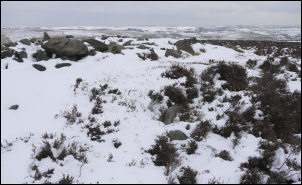
Not much to see of Miller's Grave. |
|
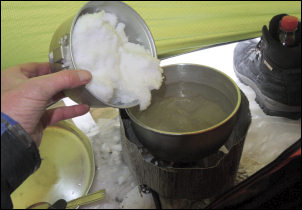
The water supply was melted snow. |
Because of the snow
I didn’t need to find water for my camp so I headed for a large
boulder called Robin Hood's Penny Stone a short distance to the NW
and pitched my tent on a flat piece of ground close by. A bin liner
filled with snow was my water supply. |
|
The wind was getting up but not too
bad for the tent. It did mean that I had to zip up the tent inner as
the snow was blowing under the tent in to the inner area. |
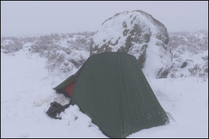
Camp at Robin Hood's Penny Stone. |
 Return to
Whittle Wanderer
Return to
Whittle Wanderer