|
|
Lat/Long: 56.830928, -04.220030
OS Grid ref: NN 64554 73231
|
|
|
|
Last night's camp was by the Schiehallion Road but the ground
was very wet and soft in parts so I had a bit of trouble getting
out. After a dark and very windy drive I reached Dalnaspidal
Lodge off the A9 near the Drumochter summit. I was away shortly
after 7am as I was hoping to get back for the 11am 2 minute
silence as it is 11/11/22 anniversary of Armistice day. I didn’t
make it. It was still very windy and was forecast to continue. I
wasn’t sure of the rain situation as the forecast was for heavy
rain to the north. I put my leggings on anyway and set off north
along the old abandoned A9 that is now a cycle track. |
The old A9 is now a cycle track. |
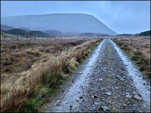
Boar of Badenoch in the distance. |
|
I had the strong wind on my back and also light rain. The high
tops were obscured by cloud so little to see as I peered ahead
on my way to the Valley Dhomain to the left. I could see the
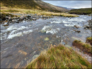
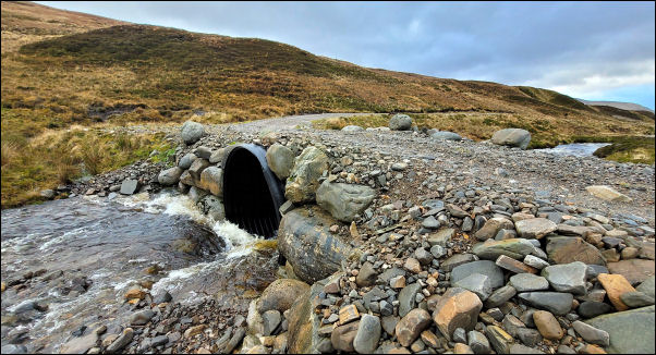
railway to my left then up ahead the underpass where my track
went. My first concern was that I would soon have to cross. When
I got there the stepping stones were under water but it wasn’t
too bad to wade. It formed from 2 other rivers joining so I
walked upstream on the first river and soon found somewhere to
jump across. The next smaller river was easily crossed then I
continued up the valley track heading west. The rain wasn’t
heavy but persistent. Higher up I reached the left branch and
the vehicle bridge where I crossed over to continue up the
hillside. I was heading for the valley I’d seen last month and
I’d checked out the google maps to find a way up. I found a
faint quad bike track going roughly the way I was heading. I
followed it up until I reached the valley entrance. I wasn’t
able to see any sign of a quad track on the aerial image but it
turned out there was one. It took me into the valley but then
petered out. There was a small stream along the bottom and steep
sides looming up either side. The rain and gloom continued but
it was good underfoot so enjoyable walking. There was definitely
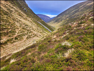
a sign of a path but nothing shown on the map. The sharp valley
wasn’t straight so the head of the valley wasn’t visible up
ahead. When reconnoitring on the computer screen I’d noticed a
rectangular shape that could have been a hut. When I reached the
spot it turned out to be a large white rectangular boulder. |
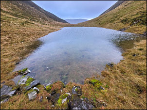
Pond in the hidden valley. |
Head of the hidden valley. |
|
A pond appeared which I hadn’t seen on the map though it was big
enough to be recorded. Eventually I reached the head of the
valley which was a surprisingly easy and gentle gradient. I was
then on a route I was on last month. My original plan was to go
over the Sow of Atholl but the strong winds continued and I
didn’t see the point, even though the views had improved a
little. |
|
The plan ‘B’ descent route was by the way I’d come up in October
but looking down to Luidhearnaidh I could see the stoned track
on the opposite side of the valley. It looked closer than it was
but I decided to abandon my planned route and head straight down
the valley side. As I got nearer to the river I realised it
wouldn’t be a crossing where I could keep my boots on. I picked
up a quad bike track and followed it down to the fording point
at the river. I had to wade across but it turned out not to be
as bad as expected. |
Luidhearnaidh ford. |
An easier crossing downstream. |
|
It was nice to be on the stoned track as I descended the valley.
checking my watch I realised I wouldn’t get back to the car for
11am so when it was time I stopped on the track above the river
and stood in silence for 2mins with a few personal thoughts. I
continued down and reached the car around 11:30am just as the
rain started again. |
|
|
|
|
|
|
|