|
|
lat / lon: 54.679897, -03.005529
OS grid ref: NY 35264 32113
|
|
|
|
There was a gloomy weather forecast for my walk in Cumbria. I
didn’t expect to see much on the hills so decided on a walk up
Bullfell Beck and check on a sheepfold high on the fell as a
possible campsite. On the way I wanted to photograph the
interior of St Kentigern’s Church. I drove past Mosedale Bridge
and then up the lane towards Roundhouse. I parked on the grass
verge and walked in windy conditions back down the road and past
the Quaker Meeting Room, which was locked. |
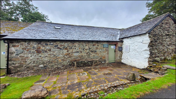
Mosedale Friend's Meeting House. |
The text below is from a notice board by the Friend's Meeting
House.
In 1653 George Fox visited Mosedale and held a meeting
at the home of John Slee in Mungrisdale, which marked the
beginning of Quakerism in the northern fells. Initially Friends
would meet at each other's houses. By the late 17th century the
number of Quakers in the area was growing and in 1702 a “house'
belonging to George Peacock, a local farmer, was sanctioned as
the 'publick place of worship of the people called Quakers'. In
1739, the present building, which was thought to have been an
open sided cart house and possibly the house referred to above,
was given in trust to Quakers. Also given at this time was a
detached piece of land to provide a burial ground. Over the
years the Meeting House has been extended and modernised; a car
park added, and the attached barn acquired. The building
continues to be a Quaker Meeting House and there are regular
Meetings for Worship at which everyone is most welcome. The
times of these Meetings are shown on the Meeting House entrance
door. The Meeting House is also available for the use of local
community groups. |
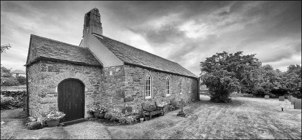
Mungrisdale St Kentigern's Church. |
|
The cloud was low as I continued south to Mungrisdale and St
Kentigern’s Church. I’d brought my tripod with me to photograph
the Church interior and the overcast conditions were good for
interiors as there was no contrasty sunshine through the
windows. The current church building dates from 1746 and the
interior reflects that. I took some images and continued my walk
into Mungrisdale. |
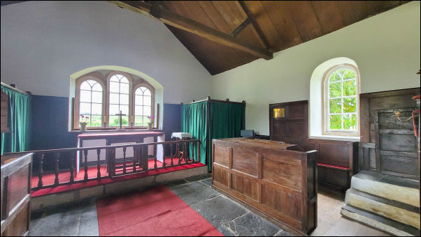
Mungrisdale St Kentigern's Church. |
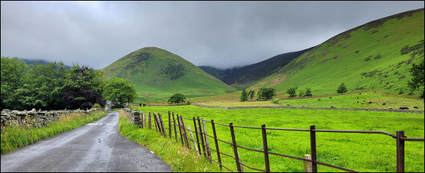
The Tongue from Mungrisdale. |
|
Then through the gate and west along the track towards Bullfell
Beck. The mound of The Tongue was up ahead and to the right the
valley I was heading for. I crossed a wet path to join the track
up Bullfell Beck valley that continues up to the old water
intake building. The square basic building appeared up ahead and
fellside mist behind. I sheltered behind the building to eat my
sandwiches then continued up the track a short way before
crossing the river and heading up the wet fellside towards the
old sheepfold higher up. Eventually I reached it to check its
location for a possible campsite. There was DAB radio but a weak
mobile phone signal. |
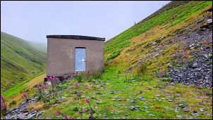
Bullfell Beck Water Intake building. |
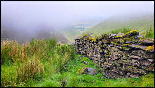
Old sheepfold. |
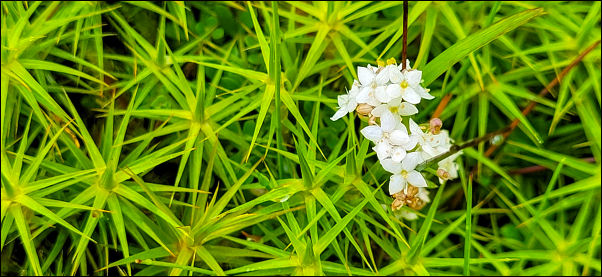
Haircap Moss & Heath Bedstraw. |
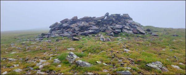
Bowscale Fell summit. |
|
The only water supply was from the stream below. The mist
swirled as I continued to climb across the sodden moss. There
was no visibility as I continued the trudge up to Bowscale Fell
summit. I was thankful to reach the track and easy walking.
There was a strong west coming in so I didn't hang around as I
started my descent north along the east rim of Bowcale Tarn
crags, though I couldn’t see the tarn. |
|
|
|
As I descended below the mist level I met 2 people coming up.
Down at Tarn Syke I descended by the steep path to the flat
valley bottom and footbridge at Roundhouse. The bridge gate
didn't have a fastening catch and swung back and forth in the
strong wind. The rain was just managing to hold off as I walked
back along along the road to the car. I was just in time as the
rain started as I got in the car. |
|
|
|
|
|
|
|
|
|