|
Millthrop, Catholes, River Rawthey, Brigflatts
Friends Meeting House, Sedbergh School, Cumbria. |
|
|
OS
Grid ref: SD 66137 91327 Lat/Long: 54.316399, -02.522047 It was a cold dark drive to the start of my walk near Sedbergh in Cumbria. I parked by Millthrop bridge in a small lay bye, mine was the only car. My walk was initially along the lanes but instead of taking the direct route I made a short diversion through Millthrop. After the short diversion I continued southwest and took a right narrow lane towards the golf course at Catholes Buildings. |
 Jordan Lane |
| The continuing Lane ahead was narrow with grass growing on the centre the reason was at Abbot Holme Bridge the parapets were extremely narrow and not many cars would be small enough to fit through. A little further along the lane I followed the public footpath which ran along the south side of the golf course. The signage was indistinct and I suspect that was to discourage walkers from being in the vicinity of the golf course. |
 Howgill fells from the old railway |
| It was still fairly dull but light was starting to appear but it did not raise the temperature which was -2 C when I left and was now -5 c. Ahead was the old Lune Valley railway bridge which has been long abandoned, I think since around 1960. The path heads up the embankment and the official route descends the far side of the Railway. However, I wanted to continue along the line of the Railway as it was a very pleasant flat green route. I continued until the next road where I climbed up an embankment and over a gate to re-join the tarmac road. The clear sunshine was now hitting the far Hills but hadn't yet reached the road. |
 Mile post on the A683 |
| Through a gate I went over the railway and down a narrow lane to Home Farm. In the season it is a caravan and camping site but is closed through the winter. I walked through the farmyard and back through to get to join the road at Jordan Lane. It was very narrow and I had to be careful of ice patches. Under a railway bridge I continued on to a path which headed right down a muddy track then back over the Railway. |
 Friend's Meeting House |
| I stopped on the bridge to admire the view back along the railway routes and the Howgill Fells in the distance. Down a steep slippery path I descended to another bridge but this was over the river Rawthey. Just over the bridge I left the road and entered the frost covered fields to head north roughly parallel with the river. I emerged onto the A683 road and followed it for a while to a right turn off for to Brigflatts Friends Meeting House. |
 New 1675 date stone |
| I visited the meeting house and have a look around inside as well as admiring it from the outside in the clear sunshine . I wanted to re-join the path along the Riverside but the farm gate said there was no access through their yard. I followed a path through the fields then left it to head south and join the Dales Way path along the River. |
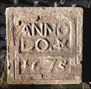 The old date stone |
| It soon reached the line of the Railway by the bridge I had seen earlier. The official path follows the railway for a short way then continues along the River. I stayed with the railway route and continued along the lovely wide green line of the railway to the next path which crosses beneath the route by a pedestrian underpass. |
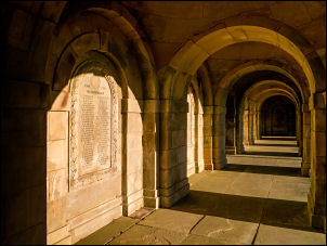 Sedbergh School Cloisters |
| I continued east following the foot path across open Fields until I came to the narrow Lane at Birks. I left this at Birks House and took a minor path by the sports fields for the Sedbergh School. The first sports field was a rugby field and I continued up into the school buildings area. |
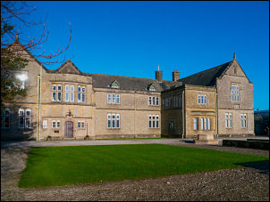 Sedbergh School |
| I continued east following the foot path across open Fields until I came to the narrow Lane at Birks. I left this at Birks House and took a minor path by the sports fields for the Sedbergh School. The first sports field was a rugby field and I continued up into the school buildings area. There seem to be a network of public access pass through the complex of buildings and I follow these to the main school entrance on the A684. I followed the road into Sedbergh then took the path by the church then onto the Dent Road. I continued along the road in the pleasant sunshine and returned to my car. By then the temperature was only just above freezing. |
 Sedbergh |
| Sedbergh School the Wilson Run. The official finish line of the 'Ten Mile' annual cross country race (10miles 385yards) First run in 1881 |
 Wilson Run finish line |
|
|
|