|
Burgh-by-Sands, King Edward 1st monument,
River Eden, Beaumont, Hadrian's Wall (course), Cumbria |
|
|
OS
Grid ref: NY 32816 59127 Lat/Long: 54.922297, -3.049754 The start of today’s walk is Burgh by Sands and I made the mistake of taking exit 43 from the M6 and driving through Carlisle. I didn’t know exit 44 would have taken round the north of Carlisle via a new road and almost directly to my walk. I parked near St Michael’s Church and headed north along the narrow lane to the north. My first objective was to check out the Ordnance Survey Trig Post in the corner of a field. |
 Trig post in the corner of a field |
 The location where King Edward 1st died in 1307 |
|
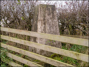
 King Edward 1st Monument |
 King Edward 1st (Longshanks) |
| As I arrived a lady was walking her dog along the lane. It must be one of the lowest altitude posts I’ve visited at around 30m above sea level. I continued along the lane then left it to follow another lane to the left and muddy track towards the marshes near the Solway Estuary. There was a small parking area which I could have used. On the grassy flats of Burgh Marsh I headed for the fenced off column memorial to the spot where King Edward 1st died of dysentery on 7th July 1307. |
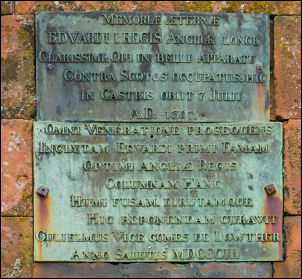 Latin information |
| Thomas Langstaffe built a monument to the death site in 1685 that was destroyed in a flood but replaced by a 20ft pillar in 1803. The description plaques high on the stonework are in Latin and it would have been useful to have had a modern panel at eye level. I continued across the grass to a concrete building that seemed to be of WW2 vintage. |
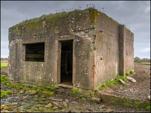 Concrete building |
| Further on I came to Old Standsfield and terrace of stone houses. The path ran along the Solway shore to a gate where I followed a track by a farm and back to the road. I soon left the road and headed across grassland to the river bank. The path was very indistinct and only the occasional stile marked the route. |
 Solway coast |
| I continued for about 2 miles across featureless fields then onto the riverbank with dense undergrowth. The path had been washed away and it was very difficult finding a way through. Eventually I gave up and climbed a steep bank to the road above. Further on a sign said the path was closed. I had to abandon part of my planned route and head into the village of Beaumont. I had a look in St Mary’s Church which is built on a small hill and also on the line of Hadrian’s Wall. The church dates from the late 12th century and partly constructed with stone from the Roman Wall. It was restored in 1872. |
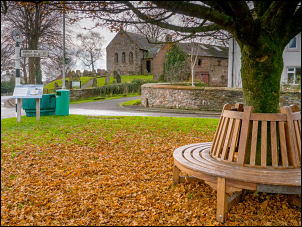 Beaumont |
 St Mary’s Church Beaumont |
 St Mary’s Church interior |
 Beaumont now |
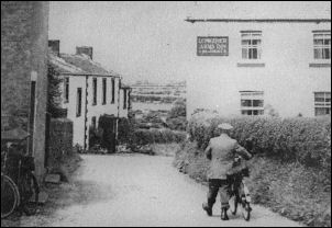 Beaumont then |
| I left the village by Hadrian’s Wall path which follows a muddy track. After half a mile it is on the line of Hadrian’s Wall and a faint ditch can be seen. I reached the road then back into the filed for a while to emerge at the road again and across to St Michael’s Church. |
 The line of Hadrian's Wall |
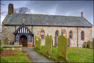
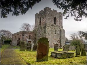 St Michael’s Church |
 St Michael’s Church interior |
| I had a look inside and in the bell tower was a display of the Roman settlement that used to be on the site and also details of King Edward 1st whose body was brought here in 1307. King Edward's body was brought to Burgh Church in July 1307 to lie in state before being moved to Carlisle then York and reaching Waltham Abbey on 14th August where it remained until 18th October. |
 St Michael’s Church |
| He was then moved to the Priory of Christ Church at Aldgate, London and next to St Paul's Cathedral. The funeral was conducted on 27th October 1307 in Westminster Abbey where the King was then buried. |
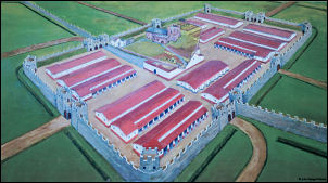 The Roman Fort where St Michael’s is now |
|
|
|