|
Park
Fell (Alston), Horse Edge, Scarberry Hill, Benty Hill, A686, Cumbria. |
|
|
OS Grid ref:
NY 70031 43523 Lat/Long: 54.785707, -02.467525 I started from the minor road near Leadgate where there was plenty of space to park a car. I set off north along the unmade track, across the busy A686 and along the continuing rough track. It was unsurfaced but OK for a robust vehicle. Up ahead I could see the tail lights of a vehicle. As I approached it kept moving forward at walking speed. I followed it for over a mile and noticed that by the vehicle were two dogs walking alongside. |
|
 Dog walking the lazy way |
|
| It turned out the driver was taking the dogs for their walk while driving. At the end of the unmade track I reched the tarmacked road going to the right. I turned left, though a gate and up a grassy track to the empty Nether Park Farm. |
 Nether Park Farm |
| As I passed I went inside for a look. The roof was still on but the animals had filled the interior with muck. Sections of floor were falling through. Further up the field was another empty building but this was a ruinous bungalow which was mostly made of asbestos sheets and was on the verge of falling down. |
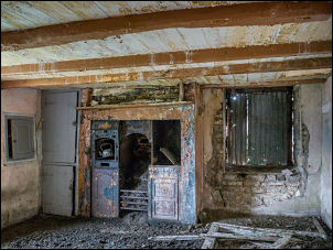 Nether Park Farm interior |
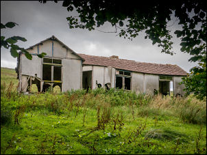 Old bungalow near Nether Park |
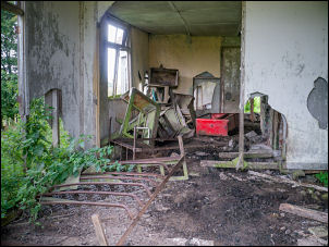 Bungalow interior |
| I headed up through a couple of gates to climb up to the ridge summit and had great views down to Alston. On park fell I crossed some very rough ground to reach the trig post. There was a lot of evidence of old mine workings with many scars on the landscape. I descended to a gate and started to follow the fence up along Horse Edge. |
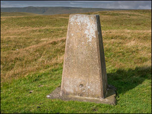 OSBM S6576 |
| The start of this is also where the map shows the Maiden Way Roman Road passing through but I couldn’t see any evidence on the ground. I continued along the fence line to Scarberry Hill where the boundary became a stone wall. |
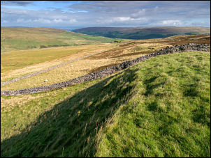 Looking down on the Maiden Way |
| The summit of Scarberry Hill was a high point but just lower than Benty Hill in the distance. I continued to Benty Hill with its interesting features on the summit. Many limestone boulders were strews around and on the north side was an intricate system of walls that looked like they were for sheep sorting. |
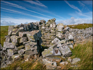 Old Anthony Chair |
| The map seems to call them Parkin’s Stones but that could also mean a random pile of stones nearby. Over the fence was a old stone shelter called Old Anthony’s Chair. I started my descent back to the main A686 and had originally planned to follow the wall down. I noticed a line of wooden shooting butts and a vehicle track connecting them. |
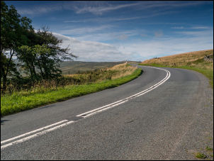 Reaching the A686 |
| This was a very easy descent so decided to follow it down to a gate by the road. Once on the road I headed directly back to may car but had to be constantly moving on to the rough adjacent grass as there was no footpath to avoid the constant approaching traffic. |
 Seen on the drive home |
|
|
|