|
Bampton, Drybarrows, Bampton
Common, Towtop Kirk, Cumbria. |
|
|
OS Grid ref:
NY 51804 17615 Lat/Long: 54.551473, -02.746639 It was a good weather with blue sky and no wind as I drove along the M6 to Shap on my way to start a walk near Bampton. As I left the A6 at Shap I soon came to a ‘Road Closed’ sign and had to diver via Askham to reach the start of my walk at the parking area by Halfa Bridge. It is a two arch mid 1700s and grade II listed. |
 Up the lane |
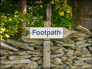
| I set off walking along the lane to the SW, crossed the road and continued up the narrow lane towards Winder Hill. Before the end of the road I left it to follow a path through the fields towards Drybarrows. When I’d almost reached the farm buildings I noticed a footpath sign pointing away from the official path which goes by the main buildings. I followed the diversion which took me on a loop and re-connected to the correct line at the other side of the property. |
 Building around nature |
| The last time I was here there was a sign pointing in the correct direction and I remember walking past the buildings. I suspect the diversion is unofficial. I was now following a track across the open fell and headed SW towards Four Stones Hill. |
 DIY diversion |
| There is an ancient cairn at the base of the hill with a more recent circular stone wall built on it. |
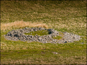 Ancient cairn |
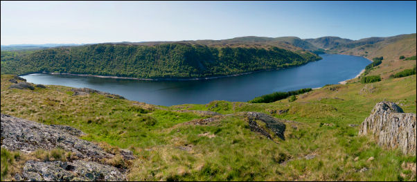 Wide view of Haweswater from Four Stones Hill |
|
| I walked up the hill to get a superb view of Haweswater Reservoir then back down the other side to inspect the two small standing stones. They are shown as ancient on the map. |
 Shooting Butt and view to Great Cockup |
| I headed up the steep hill opposite to join the track heading for the old quarry area. At the old quarry was a ruin and some spoil heaps. It looked like slate was quarried. Further up the hill I came to the old boundary stone shown on the map. It was quite small and didn’t have anything carved on it. I was on Low Kop at 576m (1,890ft) and the highest point of my walk. |
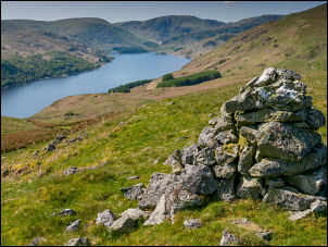 Higher view of Haweswater |
| I changed direction to the NE to start my descent. The clear weather this morning was starting to cloud over but still mostly sunny. The views were excellent and I was surprised that I hadn’t seen anyone else. After a mile I’d reached the bottom of the ridge at Kowtop. There is a fork in the path and the official line is to the left and a ford across Cawdale Beck. I followed the path to the right as there is a footbridge and the interesting feature of Kowtop Kirk. A low sign recommends taking the footbridge route. |
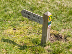 Low signpost |
| The feature called Kowtop Kirk is a circular mound but no standing stones. The 1860s map calls it the site of a Chapel. I crossed the stone slab footbridge then across some boggy ground to join the minor road at Moorahill Farm. |
 Stone footbridge |
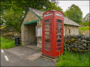 The telephone box today |
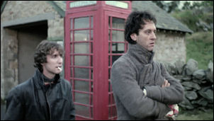 A scene from Withnail & I. |
|
I descended for just over a mile to the road at Bampton and the phone
box adjacent to the bus stop shelter. This is an interesting location
as it was used during the filming of the 1987 cult classic film ‘Withnail
and I’.
I walked past the village shop and post office along the lanes and back to my car. |
|