|
Over Water, Great Cockup,
Longlands, Binsey, Cumbria. |
|
|
OS Grid ref:
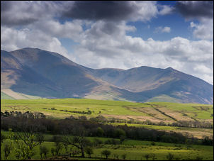
NY 25535 35368 Lat/Long: 54.707791, -03.157210 The drive to the start of my walk was uneventful. I was fortunate that the A591 was clear and so was the minor road through Orthwaite. I left my car in the unsurfaced car park by Over Water and set off walking back the way I’d come. South of Orthwaite Hall I left the road and headed up a track which climbed gently up the fell and had nice views across to Skiddaw. |
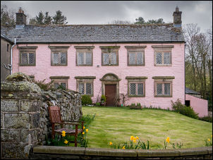 Orthwaite Hall |
|
Orthwaite Hall and Adjoining
Barn are Grade: II* listed by
English
Heritage with a building ID of: 72434 |
 Orthwaite Hall |
| Then a minor green trail to the left took me steeply up towards Brockle Crag. At the high point the track fizzles out but a faint path heads off left towards the ridge towards Great Cockup. |
 |
 Looking back to Skiddaw |
|
|
It was a bit rough underfoot but dry. I saw a couple of stone shooting
butts which looked rather old and could be mistaken for ancient
structures. The summit of Great Cockup and a very small cairn. There was
still low clout obscuring Skiddaw summit but I still had a good view of
the lower fells. Although I’ve been on many of the surrounding paths this
is my first visit to the summit of Great Cockup. I enjoyed the steep path
down to Tramadoor which is a steep sided gully and very impressive. I’d
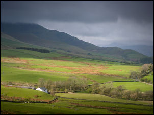
tried to phone Jeff at Longlands to see if he was in but had no signal. he funny thing is I could see his house from the summit. It turned out later that he could see me. I took the minor path to the north but it soon veered off from the line shown on the map. I crossed the minor River Ellen and took the track north. |
 Shooting Butt and view to Great Cockup |
| I descended Longlands Beck then up the road to visit friends for a cup of tea and chat. I returned back down the road then followed the farm track to the dam at Chapelhouse Reservoir. The overcast weather was now brightening up and I stopped to have my sandwiches. The reservoir is still used to supply drinking water. |
 Chapelhouse Reservoir |
| I reached the road, tuned right for a while then left along a rough track through an avenue of trees. At the next road I turned left to Binsey Cottage where I went through the gate in the wall to stat the easy climb of Binsey. |
 Binsey Gatehouse |
 You have been warned |
 View from climb up Binsey |
|
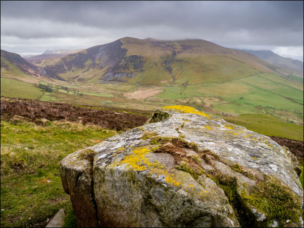
It still felt cold in the wind and over Great Cockup had been 4degC. By
the summit trig post and cairn I had good views of the Skiddaw massif. I
continued over the top and descended steeply down West Crag to an old
quarry which was now overgrown. I continued my descent to the gate with
the intention of following the bridal way to the south east. |
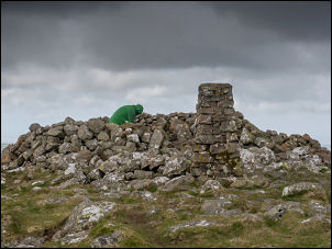 Binsey summit |
|
It is clearly shown on the map but there is no sign of it on the
ground. I followed the line anyway and had a rough walk until I reached a
gate and descended to Fell End and the farm. Along the lane the farmer was
herding sheep and I stopped for a brief chat. He’s just seen his first
swallow of the season and said it was 17 days later than last year. Along
the lane I returned to Binsey Cottage Gatehouse then by Whitefield Cottage
and back to Over Water and my car. |
 Skiddaw from the descent of Binsey |
|
|
|