|
Haweswater, Riggindale Crag,
High Street, Bampton Common, Cumbria. |
|
|
OS Grid ref:
NY 46950 10736 Lat/Long: 54.489177, -02.820436 I reached the car park at the south end of Haweswater around 07:50am and there were already two cars there. The sky was clear but the sunshine hadn’t reached the car park yet. I followed the path around the south end of the reservoir then towards The Rig. Before getting there I took a steep rough track up the fell side to join the main ridge up to Riggindale Crag. |
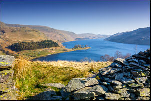 Haweswater from Riggindale Crag |
|
Although the sky was clear blue
there was quite a bit of haze and the distant views were partly obscured.
Down below in Riggindale is where the last Golden Eagle was seen in
England though it’s been some years since a sighting. The Cumbria Bird
Club update says, April 2016: "England’s last remaining golden eagle has failed to appear this spring, leading RSPB staff and volunteers at its Lake District home to fear that it has died." The male has been alone since the female died in 2004. He displays, particularly in Spring, to mark his territory and attract a female from Scotland. |
 Blea Tarn |
 Windy surface of Blea Tarn |
|
| I reached the small tarn on the ridge where I could look down on the impressive Blea Water deep in its own bowl of steep screes. Although the surface area looks small it has a max. depth of 63 m (206 ft) the deepest Tarn in Cumbria and the third or fourth deepest Water in Cumbria. The ridge steepened up to High Street where I visited the trig post at 828m. |
 High Street trig post |
| The area is known as Racecourse Hill. I then headed north along the line of the Roman Road to the Straits of Riggindale were I turned right and up to High Raise. I continued north to Keasgill Head and was surprised that I didn’t anyone the whole way. As I descended to Bampton Common there were plenty of people about but they were mostly sitting around in the sunshine. I descended down to Fordingdale Bottom and had to find the best way I could as there was no path and the maps route down was fictitious. |
 View along High Street |
| I reached the main west bank path by Haweswater and headed south and back towards the start. The weather was sill sunny and had warmed up considerably. There were now many people about enjoying the fine weather and easy walking. I had a good view of Castle Crag ahead which is reputed to be the site of an old fortification. I visited it many years ago but didn’t see much evidence. I approached The Rigg then over the ridge to descend the path I’d used on the walk in. I was soon back at the car and a very full car park. |
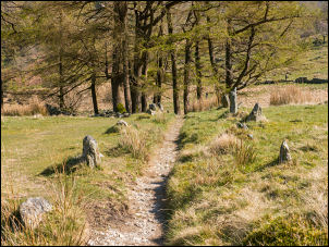 Path approaching The Rig |
 Sunny view of Haweswater from The Rig |
|
|
|
|