|
Hound Hill, Hadrian's Wall,
Housteads Fort, Hotbank Crags, Sycamore Gap, Northumberland. |
|
|
OS Grid ref:
NY 74286 68114 Lat/Long: 55.006916, -02.403566 I decided to investigate another at length of Hadrian's Wall today and drove via the M6 and Carlisle to the wonderfully named place of Once Brewed. Here I left the main road and turned north up a minor lane to the official car park adjacent to Hadrian's Wall. As it is official the charge is £4 per day so I decided to continue along the lane to a layby where I was able to leave the car. |
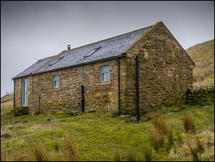 Eastbank Holiday Cottage |
 Sycamore Gap from the north |
|
| I started my walk by following an unfenced Road towards Giggs Hill and before reaching there I turned off to follow a minor track across fields to the holiday cottage of Eastbank. This is not an official footpath but there were no particular obstacles in the way. |
 Heading towards Houseteads |
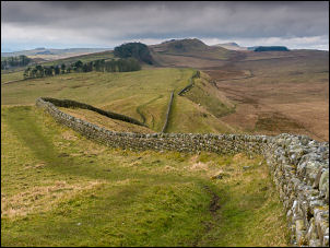
| I headed up the hill, crossed through two gates and past Hound Hill Plantation to join the official footpath heading east. So far it has been good underfoot but as I reached the buildings of Longside the ground became very wet. To the south I had a good view of Sycamore Gap on Hadrian’s Wall. I approached the buildings of Hot Bank then continued along the path heading north east. It continued very wet and was it difficult in places. I crossed the line of the Pennine Way and eventually climbed up steeper ground to reach a gate onto the official line of Hadrian's Wall at King’s Wicket. |
 Housteads in the distance |
| The wall here is not the full width and is obviously built from roman stone. I continued along the line southwest following the official path. There were excellent views as I continued towards Housesteads Roman Fort. |
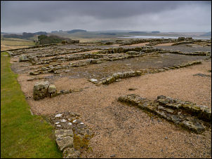 Housteads |
| Through some trees I reached the full width wall which I climbed onto and walked to the Roman fort site. In the fort area I crossed the well maintained grass and left by the Westgate which was unfortunately locked. This meant that I had to climb over to re-join the wall path. |
 Conducted tour |
| For a while it went through an avenue of trees heading roughly west. There were now a few people around. After Hot Bank Crags I met a large party of students walking the opposite way. They had a leader with them who seem to be giving them a conducted tour of the wall. |
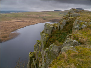 Crag Lough from Highshield Crags |
| I reached Sycamore Gap where the famous sycamore tree is and stopped for a while to take a few photos. I climb up to me along Peel Crags and eventually a steep descent took me down then up to the the official car park near Turret 39B. Here I joined the road and a short walk back to the car. |
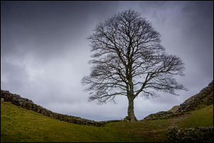 Sycamore Gap |
|
|
|