|
Rosal clearance village,
Strathnaver, Scotland. |
|
|
OS Grid ref:
NC 69055 42712 Lat/Long: 58.353271, -04.239277 I drove to Syre and then across the bridge to a rough track on the east side of the River Naver. The map shows it as not being adopted but a sign says there is a car park further along. I drove along the unsurfaced track to a small area with a picnic table and space park a few cars. I set off walking along the same track into the forest to explore the old clearance village of Rosal. |
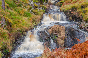 Stream running in to the River Naver |
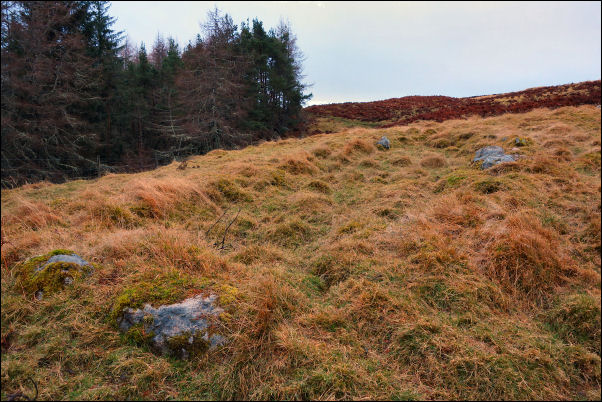
 One of the Rosal ruins |
|
|
I reached a point where
the path leaves the track and heades up into the woods to reach an
open area which was very well signposted with excellent interpretation
boards. Around the village area it was possible to get a good idea how
life must have been like over 200 years ago. A diary was published in
the 19th century called Gloomy Memories by Donald Macleod.
The township was situated on the Sutherland estates of the Duke and Duchess of Sutherland and was cleared between 1814 and 1818 by Patrick Sellar, the Sutherland estate factor. The inhabitants were moved to crofts on the coast and their land became part of a sheep farm rented to Patrick Sellar. I spent my time wandering around and taking in all the various ruins and was surprised that nobody else was visiting. |
|
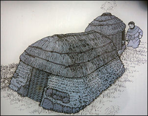
 Drying hut |
|
 Drying hut |
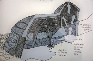 Drying hut (cutaway view) |
|
When I eventually completed the circuit of the area I set off back
through the woods by a suggested alternative route. I soon realised
this was a mistake as recent forestry works had completely obliterated
the path and left many piles of timber in the way. Once through those
obstacles I still had many more to come as many storm damaged trees
were still across the path having been blown over. Many long detours
ere needed to get round them. I was very glad to leave the forest and
return to the car park. It would be better to have left that stretch
of path out but I wasn't to know that.
|
|