|
Greenhead, Hardian's Wall,
Thirlwall Castle, Popping Stone, Birdoswald, Gilsland, Northumberland. |
|||||||
|
OS Grid Ref: NY 65770
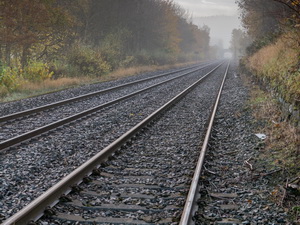
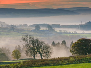
65882 The drive along the M6 was a mix of fog and clear views. I reached a small car park on the B6318 just off the busy A69 trunk road. It was an odd shape and not good to get many cars in. At least it was free. I followed a path to cross the railway then along the bank of Tipalt Burn. In front of me was the impressive ruin of Thirlwall Castle. |
|
||||||
|
It was built by John Thirlwall about 1333 using stones plundered from the nearby Roman Hadrian's Wall. Around 1738 the castle was no longer a residence of the Thirlwall family due marriage. Shortly after it fell into disrepair. |
|||||||
|
|
|||||||
|
|
||||||
|
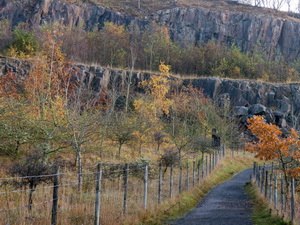
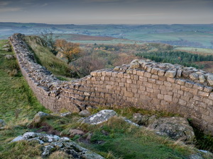
After the castle I returned down the lane and over the Tipalt Burn by a footbridge by a ford. Then up a hill I was walking by the ditch along the line of Hadrian’s Wall. It was an impressive walk along the hill tip to the road by the Walltown car park and information centre. The current car park is the site of the crushing are for the quarry that used to be here for over a hundred years. |
|
||||||
|
The extent can still be seen by cliffs in the distance. Many kinds of stone products were produced including setts to pave the streets of Newcastle, Manchester, Liverpool and Carlisle. My map showed the site of the Turret 45b on the wall but there was no sign of it now as the quarry had cut it away. However it was excavated in 1883 before being obliterated. |
|
||||||
|
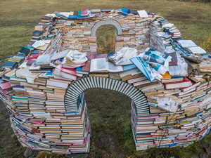
As I walked towards Walltown Crags I noticed a white structure on the far side of the old quarry area. There was no path to it so I walked across the open land. There I round a replica Milecastle made of old books. The paper sign adjacent says: |
|
||||||
|
Simulacrum |
|||||||
|
The Simulacrum mirrors
the military structures that were once found along the wall drawing from
the precision and geometry of Roman structures in contrast to the
subsuming natural environment. The sculpture will begin to decay almost
immediately — rain will permeate the books, the sun will crack the book
covers and plants will begin to take root. This will mirror the act of
ruination of the stones itself, be it at an accelerated pace. We have
recycled books destined for pulping or landfill — once the installation
ends the books will be recycled further into paper products or
incinerated with the energy harvested for the Northumberland power grid.
|
|
||||||
|
There were some nice
books left out on the weather and I can’t agree with the plan of leaving
them to deteriorate by design. |
|
||||||
|
At the next dip at an area called King Arthur’s Well I left the line of the wall to head north along a rough track. Through a gate and some very wet ground I headed across boggy ground to Collar Heugh Crag. I sat by the stone wall to eat my sandwiches in the sunshine. |
|
||||||
|
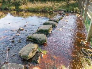
Over the wall the path soon joined a single track road where I turned left and after half a mile right to the isolated farm of Low Old Shields. Through the farmyard I followed the path through a field but the map shows it going through the adjacent field. I reached Tipalt Burn again where a set of stepping stones are called a ford. As I approached I was disappointed to see that a wooden footbridge had been constructed. |
|
||||||
|
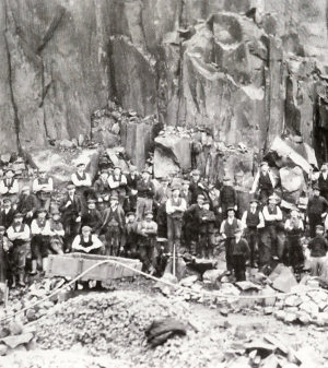
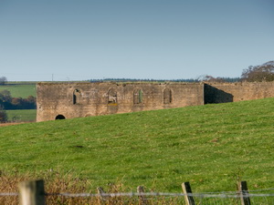
The stepping stones were large and substantial but I suppose health and safety has had a hand here. I crossed by the bridge then up the lane to Wood House where I left the road to descend adjacent and old sunken lane in the field. I descended to Pow Charney Burn and some very wet ground. The path followed the railway then across a field to the access track to Barron House Farm. I could see the remains of a large stone building in a field. It looked industrial and was very large. Walking through the farm yard I saw someone in a building and asked about the building. I was told it was something to do with old coal workings. A later check on the old maps showed it was part of the Thirlwall Colliery which had a link to the rail line and also a rail track running to the NE. it was in operation from around 1910 to 1926. |
|
||||||
|
|
|||||||
|
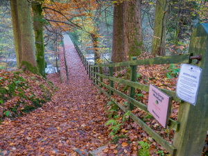
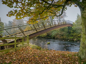
I left by a track heading up the hill to the NW then across a field to a tall wooden stile over a stone wall. On the top I stepped over but the misty weather had covered the slimy wooden step so my foot slipped off. I finished up falling and down the steps to land in the wet grass and mud on the far side. I was winded but unhurt. The path continued to the road where I turned left then right to a track to a large house up for sale. I minor path headed through the woods to descend to a footbridge across the River Irthing. |
|
||||||
|
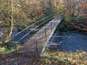
I passed the first bridge and on to another bridge over the river. |
|
||||||
|
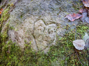
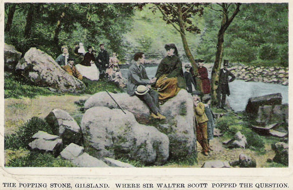
I saw a sign pointing to the Popping Stone but no indication how far it was. I checked the map and saw it wasn’t far so headed off to investigate. The path was slippery and muddy at first but improved further along. I didn’t know what I was looking for and soon reached a rounded stone covered in moss. It matched the location shown on the map and when I saw some carvings or graffiti on it reckoned I was at the right place. |
|
||||||
|
Many thanks to Gilsland Bits & Pieces and WH? (Will Higgs) who wrote it. The postcard photo below is from his website. |
|||||||
|
|
|||||||
|
I returned to the bridge and continued up the hillside to join the road. I stayed on the road through Gilsland and on to the Roman Fort at Birdoswald. This is the second time I’ve visited the site. The first was on a back-packing walk along the wall with Charlie in 1977. We were walking from the east to the west and reached Birdoswald on Wed 27th July 1977. We had to pay 10p to walk round the fort ruins, I didn’t walk round the fort site but headed along the wall. Somewhere on the south face of the wall is a carved phallus and I managed to find it in 1977. |
|
||||||
|
I think it is one of only three on the line of Hadrian’s Wall. I reached the descent to the River Irthing but didn’t see it. The path took me down to a footbridge which was built in 1999. When I crossed the river with Charlie in 1977 we had to hop across the rocks and I made a note in my diary that we managed to do it without taking our boots off. |
|
||||||
|
|
||||||
|
The roman bridge abutment is on the east bank and is very impressive. The wall continues up the hill and in 1977 we had to pay 5p to walk along it. At the road I crossed over then over the railway to visit the impressive Poltross Burn Milecastle. The path continues along the wall ditch which for the last mile is out in open countryside. As the mist had returned the walk was very atmospheric. I reached the B6318 and then the short walk back to my car. |
|
||||||
|
|
|||||||