|
Blanchland, Actonmill, Warlaw
Pike, Carriers’ Way, Newbiggin, Northumberland.
[16.1 km]
Thu 16 Jul 2015 |
|
|
|
OS Grid Ref: NY 96487
50437
Lat/Long: 54.848727, -02.056236
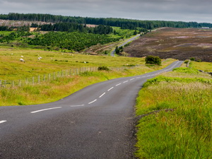
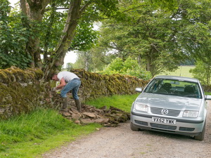
I drove via the M6, A69 and Hexham to
Blanchland. There is a sizeable car park which is free but had an
honesty box with a suggested £1 donation. That’s how car parks should
be. I walked by the large ancient gatehouse which was shrouded with
scaffolding as builders worked on it. The first part of my walk was
along the B6306, back the way I’d come. |
|
|
|
|
|
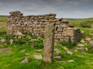
It was easy walking and
thankfully little traffic as there was no footpath. At Actonmill Bridge
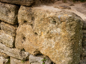
I left the road and though a gate followed a track to the ruin of
Actonmill. The remaining stones were pock marked with what looked like
bullet impacts. It is possible that is the case as many old building
were used as target practice during World War II. I was following the
line of track shown on the map but there was nothing on the ground.
After the ruins of High Actonmill I went through a gate and on to a
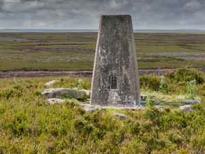
substantial track heading west across Acton Fell. All along the track
were shooting butts and in the distance I could see Warlaw Pike and the
trig post on the summit. |
|
|
That was my next
objective. On the final approach I left the fence line and crossed rough
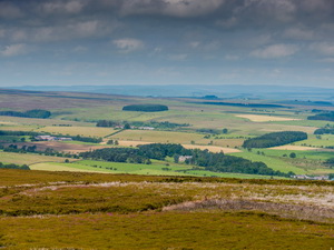
ground to the trig post. The weather was fine and I had great views all
around. I descended to the west across a short stretch of rough ground
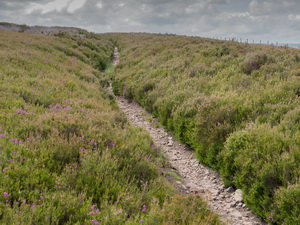
to join the Carriers’ Way path. Its name seems to suggest an ancient
way. |
|
|
On the ground it’s a
sunken path for a lot of its route which means it is probably very old.
I made a short detour to check out a barn of corrugated iron then
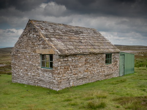
re-joined the path to continue towards Blackburn Head. In the distance I
could see a stone shooting hut and lots of vehicles parked around. |
|
|
|
|
|
|
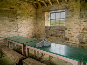
Blackburn Head hut interior |
|
|
Just before the hut was a
gas pipeline marker and nearby a stone circle of rubble. At first it
looked ancient but as its not marked on the map I’m not so sure. At
Blackburn Head I walked past the vehicles and across Newbiggin Fell were
lots of people with dogs were walking. I only saw one man with a gun and
only heard a couple of shots. I was now on a vehicle track across
Reeding Edge to Whitehill Plantation. Through the trees I descended to
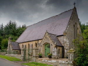
the track that took me to the group of buildings at Newbiggin. Just
before I reached the road I came to the church shown on the map but now
converted to a private residence. Over the door it said “Wesleyan
Providence Chapel 1867” It has a
fascinating history and the last service was in 1991. On same spot
in 1747 John Wesley preached. Along the road I returned to Blanchland
and made a detour round the village to return to the car park. |
|
|
|
|
Wesleyan Providence Chapel |
|
|
|
|
Wesleyan Providence Chapel 1867 |
|
|
|
|
|
|