|
Newbiggin Fell, Nookton Fell,
Halleywell, Riddlehamhope Fell, Northumberland/Co Durham.
[19.3 km]
Thu 09 Jul 2015 |
|
|
|
OS Grid Ref: NY 91015
52405
Lat/Long: 54.866336, -02.141520
I drove north along the M6 to Carlisle
then east on the A69 to Hexham. I was approaching rush hour when I got
to Hexham so it was quite slow getting through the town. I still had
quite a drive through narrow and winding lanes via Dotland and Whitley
Chapel to the start of my walk. The road goes as far as Harwood Shield
Farm but I didn’t know if there would be anywhere to park. |
|
|
Above Stobby Lea was a
wide grassy area between the road and wall so I left my car there. I set
off back along the road in the morning sunshine, turning right and right
again down a lane which passes the property called Folly. It had a for
sale sign up. I continued down the lane to pick up the path by the
property called Steel. |
|
|
|
|
|
When I got here I
couldn’t find any indication of where the path goes. I could see a path
sign on a post by a field but no way to get there. Fortunately there was
a man working in the garden who showed me the route through his garden
which isn’t marked. Down through a field I reached the farm buildings at
Long Lee where there was no marker showing where the path went through
the complex of buildings. Down through a field of long wet grass I
reached a wooden footbridge then up through fields to Low Hope
buildings. It was a well maintained refurbished building with no sign of
anyone about. |
|
|
|
|
|
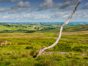
There was no vehicle but
I could hear dogs barking in kennels. I left the area by the only access
track which I followed up to Blackburn Head. A lot of track construction
work was going on with large machines working away. I reached the gate
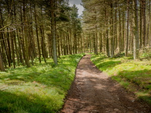
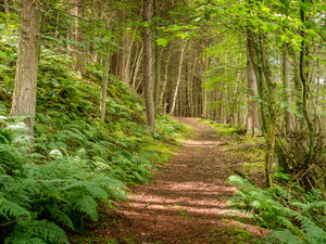
into Whitehill Plantation where I saw an Adder warning notice. The track
descended through the trees, across a field to a track. I saw a couple
of walkers approaching from the left but my way was across the track and
down through a field to a steep descent through woods to the River
Derwent. I crossed the footbridge which took me over the county
boundary. I left Northumberland to cross into County Durham. Up through
the woods and across a couple of fields I reached the road. Turning
right I followed the road passed the estate buildings and on to Nookton
Burn. |
|
|
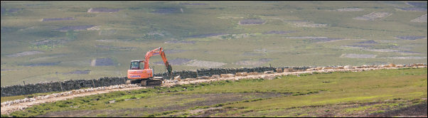
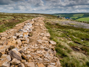
Building the track. |
|
|
|
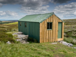
Shooting Cabin Norham Burn. |
|
|
|
|
Shooting Cabin Norham Burn. |
|
|
My map showed the path
going steeply up to Nookton Farm but I had to make a diversion near the
top to reach the farm track. Through the farm the track headed steeply
up the hillside but the path shown was not visible on the ground. I
followed up the wall to the line of a track being built with a
substantial stone foundation. Further up was another large machine
working on the track. The cost of all the track building work I’ve seen
today must be considerable. The track wasn’t on the route I wanted so I
cut across the south side of Nookton Fell to reach the correct track. |
|
|
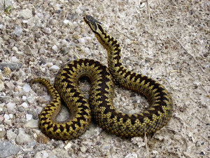
On the way I saw my first
Adder. It was curled up in the sunshine but set off into the undergrowth
as I approached. It was too quick for me and I wasn’t able to get my
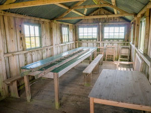
camera out in time. I followed the track to a wooden shooting hut which
was unlocked so I was able to have a quick look inside. |
|
|
|
I didn't
take this Adder photo.
It is copied from Wikipedia. |
|
|
|
|
|
|
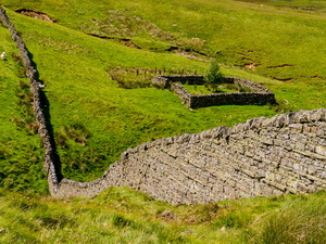
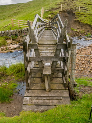
Bridge
over Quickcleugh Burn |
|
|
On the approach I was
able to look down Norham Burn to see the amazing large building of
Riddlehamhope. It was partly dilapidated but the roof was still on. The
shooting hut is by Norham Burn which is also the county boundary. I now
crossed back from County Durham into Northumberland. I followed the line
of a path shown on my map that crossed Heatheryburn Moor. It was a rough
crossing as there was no sign of a path on the ground. I reached
Quickcleugh Burn and a wooden footbridge. A sign on the bridge said no
dogs allowed. |
|
|
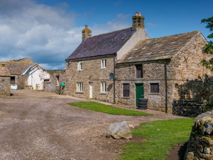
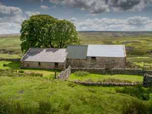
I headed up the hillside
to have a look at the substantial buildings of Hallywell. It seemed
nothing more than a large barn complex. I couldn’t see any evidence of a
house. I turned east to follow a track over Riddlehamhope Moor to the
junction of the track to Heatheryburn. I turned left to follow the track
to Harwood Shield. Here I reached the road and a short walk back to my
car. |
|
|
|