|
Slaggyford, Coanwood, Lambley
Railway Viaduct, South Tyne Trail, Northumberland.
[18.9 km]
Thu 02 Jul 2015 |
|
|
|
OS Grid Ref: NY 67609
52358
Lat/Long: 54.864946, -02.506173
My drive north started misty but stated to
clear by the time I’d reached Penrith. Over Hartside Pass there was
still some high cloud which was still there when I reached the small car
park at Slaggyford by the old railway station. I set off in warm weather
to walk south along the road then east over the bridge crossing the
River South Tyne and the lane to Williamston farm. |
|
|
Through the farm the
track heads north along the side of the hill. The rough track soon began
to head steeply up towards Stockeld Green but the path stayed on the
contour to head towards a wooded area before Parson Shields. There were
no path markers and little more than a sheep track to follow in places.
I reached a gate through the trees then emerged onto green pasture that
took me to Parson Shields buildings. |
|
|
|
|
Tidy
cobbled yard at The Bog |
|
|
|
The path is signposted to
the right of the buildings and joins a track to The Bog. The farm is
very tidy with a clean cobbled farmyard. After the farm the track is
tarmac and I followed it to Eals Bridge over the River South Tyne. |
|
|
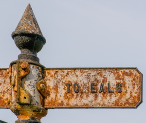
I didn’t cross it but
continued to the lovely finger post pointing to Eals. I headed down the
cul-de-sac for a while then turned right over a wall to follow the path
through fields to Towsbank Wood. |
|
|
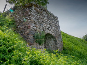
I crossed a small brook
by a substantial wooden footbridge. The unmarked path now climbs
diagonally up through the woods. I soon came across some old abandoned
mine workings. They were relatively modern, say 20 years old, but now
totally overgrown. The tunnel entrance had a metal frame around it but
inside was bricked off. |
|
|
Large metal cylinders sat
in the trees above. It wasn’t shown on my map and when I did a search
afterwards I found out why.
http://www.subbrit.org.uk/sb-sites/sites/t/tows_bank_colliery/index10.shtml
The excellent
Subbrit website had a lot of information about it saying it was only
opened in 1986 by three partners; Ted Nancarow Snr, Willie Armstrong and
Frank Shepherd. |
|
|
|
photo by Nick Catford showing the site in use. |
|
|
|
|
Mine
equipment in the woods |
|
|
|
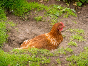
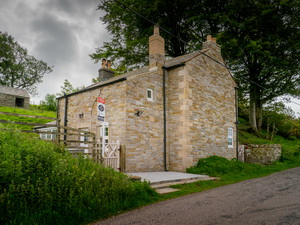
I continued up through
the trees and at least had some path marker posts to follow. I reached a
field full of deep bracken which I had to wade through to reach the open
ground to the wall and Towsbank Farm where chickens roamed freely. Up
the track I was on the high road heading north. On the right was Quarry
House which was now considerable improved and renovated after the last
time I saw it 2 years ago. |
|
|
|
|
|
|
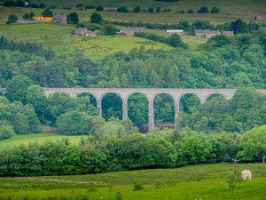
Lambley
Railway Viaduct.
Engineers drawing. |
|
|
I continued on the road
for just over a mile then crossed the wall to the left to follow a path
down through fields to Coanwood. This is where I reached the South Tyne
Trail where the road meets the line of the old railway. The railway line
was opened in 1852 and was the Alston branch. It kept going longer than
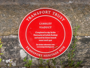
most and was eventually closed in 1976. I followed the path to the SW,
passing the old Coanwood railway station of which only the overgrown
platform remains. My main objective of the day was the Lambley Railway
Viaduct. |
|
|
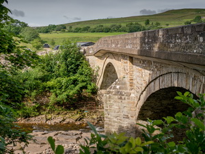
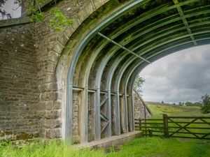
I reached the amazing
structure to see a sign saying it was only a permissive path across and
I should seek permission. The sign said:
This path is not a public right of way, but walkers are normally allowed
to use it by permission of the landowner, and at their own risk.
With no indication of who the landowner was the sign is a nonsense.
I continued over the bridge. It was built in 1852 for the Alston branch
of the Newcastle and Carlisle railway and trains brought lead and coal
down the valley to Haltwhistle station. |
|
|
|
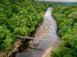
Crossing
Lambley Railway Viaduct. |
|
|
|
|
|
I reached the far side of
the bridge to the intensely annoying sight of a large barrier blocking
the way. My map shows a path continuing. A series of metal steps took me
down to the river bank then eventually emerged to rejoin the line of the
path along the railway. A sign there said the Ordnance Survey map was
wrong in showing a path. |
|
|
|
The
route is blocked. I hate this! |
|
|
The path now continued
uninterrupted along the line of the railway. I didn’t have much of a
view at first because of the trees but eventually came out into the
open. |
|
|
I met a couple coming the
other way who asked how far the bridge was. They were doing the Pennine
Way and turned out to be the only people I saw all day. After a few more
miles I was back at Slaggyford and my car. |
|
|
|
|
|
|
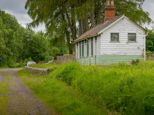
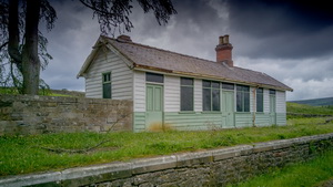
Approaching Slaggyford Station |
|
|
|
|
|
|