|
Slaggyford, Williamston Common,
Whitfield Lough, Kirkhaugh Bridge, River South Tyne, Northumberland
[19.7 km]
Wed 03 Jun 2015 |
|
|
|
OS Grid Ref: NY 67611
52355
Lat/Long: 54.864918, -02.506154
My drive to Slaggyford was through
Melmerby and over Hartside Pass. In Melmerby there were many gypsy
caravans, horses and vehicles everywhere. They must be on their way to
the Appleby fair. On the descent to Alston there some more caravans
parked on the grass verge by the road. |
|
|
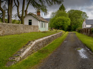
I reached Slaggyford and
parked in the area by the old railway station. I always find it odd that
a centre for good walking rarely has cars parked in it. I set off down
the lane back to the A689 then south to the minor turn off left over the
River South Tyne. Along the lane I walked up to Williamston Farm where I
wanted to take a track up onto the moors. It wasn’t shown as a right of
way so I took another track to connect with it. |
|
|
|
|
|
|
|
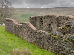
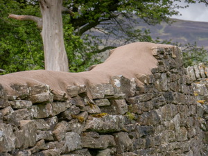
Shawhead
ruin and stabilised coping |
|
|
|
|
Shawhead
ruin and stabilised coping |
|
|
I was surprised to see a
sign on a gatepost saying permissive path. I followed the track steadily
upwards to an old limekiln where it descended slightly before joining
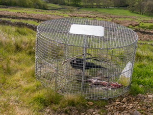
the main rough track up the hillside. I came across a cage trap by the
road with a live crow in it. I was puzzled why a crow would be trapped
but later found out the bird was live bait, presumably for a bird of
prey. Further up the track and near a gate was another cage trap but
this one was of a different design. |
|
|
A man turned up on a quad
bike to check the trap and told me about the bird in the one lower down.
He turned round and went back while I continued up the hillside to a
substantial stone shooting hut on Williamston Common. It’s a great pity
it was locked. The views down the valley were very impressive. |
|
|
I now left the track
behind and picked a way across the hillside to a line of shooting buts
going up the hill to the summit ridge fence line near Hog Hill. I turned
right (east) to follow the fence to High Bradshaw Hill towards Whitfield
Lough. I was last here three years ago but this time decided to walk
round the tarn. |
|
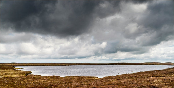
Whitfield Lough |
|
It is interesting to see
it being called a lough which sounds like an Irish name. I then took a
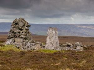
direct line to Pikerigg Currick and an interesting stone hut. It’s not
shown on the current maps but I found it on the 1860s map. Inside were
net cages and bird food so it looks as though it’s for grouse
management. Nearby is the trig post and an adjacent currick. |
|
|
|
|
Pikerigg
urrick and trig post |
|
|
|
I followed a path south
to Whitfield Law. I had to climb the low fence to continue down to
Horseman Ford at the top of a nice waterfall. I followed the fence for a
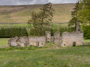
while then turned west to walk down Dewley Fell. There were signs of old
workings and further down above Dewley Field was a large spoil heap
looking like it was caused by a filled in level. I continued down to the
substantial ruins of Dewley Field Farm. |
|
|
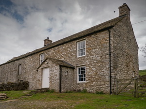
Along the track I came to
Blackcleugh Farm which was empty but had been refurbished. I think it
was in a similar state the last time I was here three years ago. I
reached the farm gate at the lane and saw a ‘for sale’ sign. Walking
along the lane I passed Barhaugh Hall with is a
Robinwood Activity
Centre for 7 to 11 year old children. |
|
|
There were a lot of
activities going on in the grounds such as rope slides through the
trees. I continued along the lane and met several groups of children
walking back to the hall. Each group had about 10 children with 2
adults. I left the lane to follow a path down to the river and a
footbridge across the River South Tyne. |
|
|
|
Footbridge over the River South Tyne |
|
|
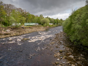
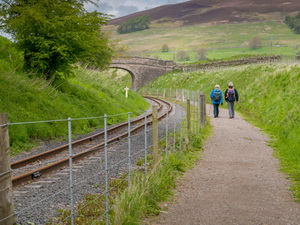
Across the field ahead I
reached a path running along the South Tynedale Railway. It is a narrow
gauge railway and I didn’t know the path ran along it. It was a pleasant
surprise as I was able to follow the railway to the end of the rails
shortly after Lintley Halt. |
|
|
|
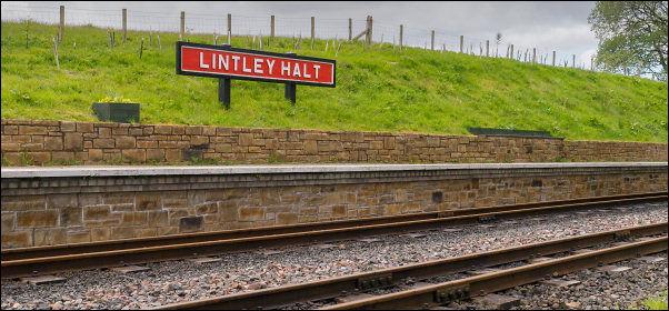
Lintley Halt |
|
|
|
|
The sign said it was the
end of the public path but access was permissive. My map showed a
bridleway continuing. I continued but the path was fairly muddy in
places. About half a mile before Slaggyford the route was so deep in mud
and water there was a diversion along the top of the bank on the right.
I reached Slaggyford and ended my walk.
My return drive over Hartside was as I feared. A wagon train of six
horse drawn caravans were holding the traffic up for miles. The caravans
I’d seen earlier had moved on but left a large pile of plastic bin bags
on the verge and rubbish strewn around. |
|
|
|
Gypsies
on the Hartside Road |
|
|
. |