|
Brothers Water, Dovedale, Priest
Hole Cave, Hartsop above How, Cumbria |
||||
 Brothers Water |
||||
|
OS Grid Ref: NY 40286
13380 It was nice to arrive at the car park north of Brothers Water to find that it was free. There are two parking areas, one by the old road which had one car in it and the dedicated parking area. Which was empty. |
|
|||
|
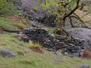
I set off south along the track to Brothers Water. I passed the farm at Hartsop Hall and almost immediately took an indistinct and unmarked path to the right which lead up through the trees to an area of old mine workings. There were ruined buildings at various levels up the hillside. I’d plotted my route using the Gpsvisualiser website and OSM (Open Street map) it is very useful because it sows paths not shown on the Ordnance Survey Map. |
|
|||
|
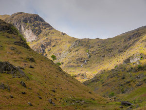
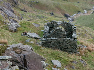
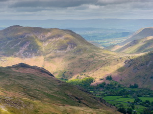
I continued steadily up Dovedale following an improving path that had some sections reinforced with rough stone steps. It was interesting to see a ruined building which was very substantial for a shepherds hut. I couldn’t see any sign of mine workings nearby. My objective was to re-visit the Priest’s Hole Cave on Dove Crag. It wasn’t visible from the Dale and even when I reached the hanging valley at the head of the dale there is no sign of it. |
|
|||
|
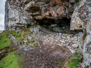
The flattish area is called Houndshope cove and I camped here many years ago. I took the faint path up towards the east face of Dove Crag. The rocky scramble soon gave way to a short path and a grassy area in front of the cave. |
|
|||
|
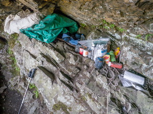
The front area had a low wall built and inside was old tins of food and various other items that could be of use to those needing shelter. I sat there to eat my sandwiches then returned down back to the cove. A good path took me up to the head of the cove where I was hit by the full blast of a strong westerly wind. |
|
|||
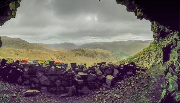 View from Priest's Hole Cave |
||||
|
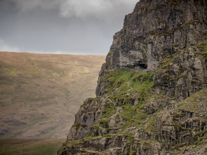
I turned right to follow a stony route through rocks to Hart Crag then tuned right to head down towards Hartsop above How. In bad weather this can be difficult to find. The first part is quite steep and scrambly in placed but on Hoggill brow is pleasant walking. Looking back to Dove Crag iy is possible to see the Priest’s Hole Cave very clearly. |
|
|||
|
I followed the ridge all the way to Deepdale Park where the path descended into the trees and down to the A592 main road. There is no path by the road but thankfully there is a path through the woods at road level all the way back to Cow Bridge and the car park. |
|
|||
|
|
||||