|
Barnard Castle, Teasdale Way,
Cotherstone, River Tees, Co Durham. |
|||||||
|
OS Grid Ref: NZ 04738
16802
An easy drive along the M6 & A66 to
Barnard Castle. I parked in one of the streets to the West of the town. |
|
||||||
|
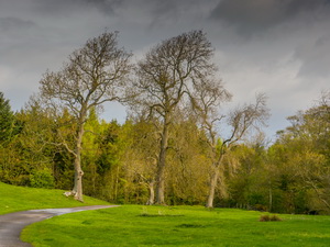
It also carries a footpath across the river. I was on the road for a short while then followed a tarmac track to the right across open fields. This was the Teesdale way and I followed it as far as the woods where there were a couple of houses |
|
||||||
|
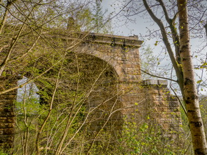
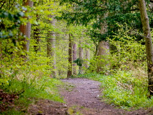
I left the track and headed through dense woodland. Up a head loomed the large stone structure of the railway viaduct that used to cross the river at this point the span across the river had long since been removed. |
|
||||||
|
|
||||||
|
Across the line of the old railway I entered open fields high above the river tees and continued to a fence at Towler Hill Farm. There was no footpath marker so I finished up on the wrong side of the hedge and had to climb the fence. Once over I was out in to open fields which I followed to Towlerhill plantation and descended through the trees. Considering I was so close to the river Tees I didn't get a chance to see much of it. I reached Cooper House which has ‘private and no entry signs’ around it then turn left on the access track and followed it to Mire Lane. |
|
||||||
|
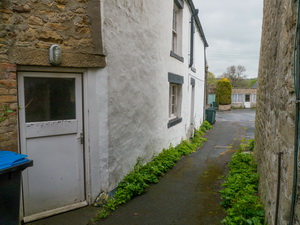
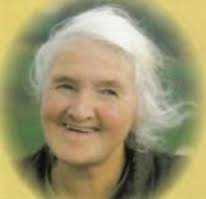
The lane took me to the main road at Cotherstone where I turn right and continued to the Red Lion pub which now seems to be a restaurant. 2 doors away was the house where Hannah Hauxwell lives. I couldn't tell if anyone was at home but it looked very dilapidated inside. I continued along the road to the post office where I went inside to ask if Hannah Hauxwell still lived in the village. They confirmed that she did and was living a quiet life. |
|
||||||
|
I continued along the road to the Fox and Hounds Inn where I sat outside to eat my sandwiches. Up to now the weather has been overcast but now its began to rain slightly. I continued my walk by crossing the road and following a track and very muddy path to the site of Cotherstone Castle. |
|||||||
|
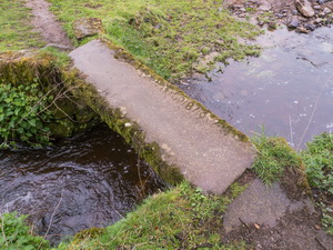
It turned out to be nothing more than a raised area in a field with no visible remains showing. A steep path took me down to the shore of the river tees where I crossed a footbridge and then along a short length of path to another footbridge, this being much longer as it was the main crossing of the Tees. |
|
||||||
|
|
||||||
|
On the north east bank the path opened out into lovely green fields and countryside. Most of the way was no following a stone wall to my right then eventually to a small waterfall. I followed a muddy track to Westholme House Farm where the path by-passed to the south and then crossing more fields and down a steep path to the river level. |
|
||||||
|
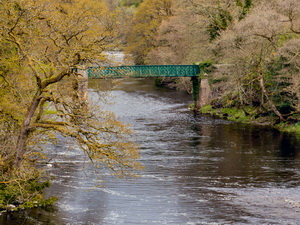
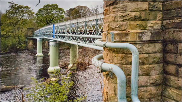
The path then followed very close to the river edge and was at the base of a rock cliff and steep slope. It was interesting reaching the northern side of the railway viaduct and I was able to see the extremely good stone work. A short walk further on I reached the Aqueducts Footbridge where I had originally started my walk. Then it was a steep climb up the muddy path back to my car. |
|
||||||
|
Tees railway viaduct. The bridge was 732 feet (223 m) long and 132 feet (40 m) high. It was built in 1860 and demolished in 1971. It was designed by the railway's engineer Thomas Bouch, who also designed the ill-fated Tay Bridge, which famously collapsed in 1879, ending his career. |
|
||||||
|
|
|||||||
|
|
|||||||