|
Barningham, Greta Bridge, St
Mary's Church ruin, River Greta, Brignall Mill, Co Durham.
[19.6 km]
Wed 08 Apr 2015 |
|
|
|
OS Grid Ref: NZ 07864
10090
Lat/Long: 54.486092, -01.880123
The weather forecast was good. I had a
pleasant drive along the M6, Tebay and A66 to the Barningham. It’s the
first time I’ve visited this part of the countryside and I had a couple
of objectives to check out. I left my car in a small unsurfaced car park
to the west of the village then walked back to the village and down its
main street. The houses were well cared for but the old Post Office is
now a private residence. |
|
|
|
|
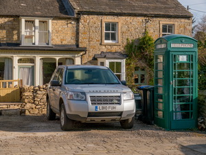
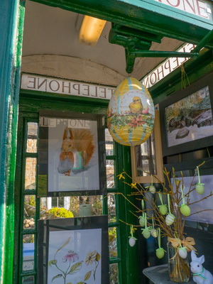
The old
Post Office and Green Room |
|
|
|
Outside was a green
telephone box, now called the green room. It is used for various
displays. Further along I came to the bus shelter which had various
current newspapers piled on the seat. It looks like they are for
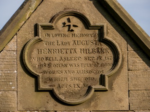
collection by the locals. As I left the village I passed the Milbank
Arms on my left. I couldn’t figure out if it was in use or not. |
|
|
|
|
|
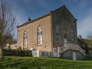
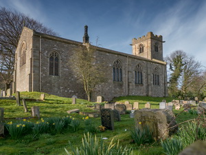
Outside
the Church of St Michael |
|
|
|
|
|
|
Outside
the Church of St Michael |
|
|
I took a minor track
round the church of St Michael and joined the road north to return to
Greta Bridge. Though the road is now a dead end it used to be the main
route through before the current A66 was built. |
|
|
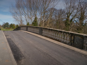
The buildings adjacent to
the bridge were tidy and impressive. The bridge had nice parapets of
stone columns.
There is a nice painting of Greta Bridge by John Sell Cotman c. 1806.
Over the bridge then over the wall on the left I entered the field and
walked along the path that follows the River Greta. |
|
|
|
|
|
|
Greta
Bridge by John Sell Cotman c. 1806 |
|
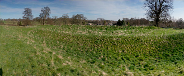
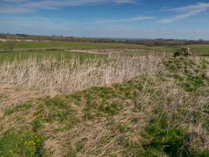
The fort was occupied from the early 2nd century to the late 4th
century. |
|
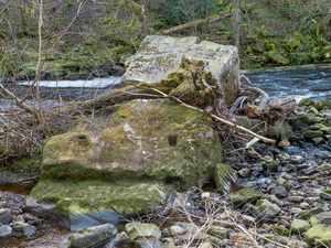
I made a short detour to
look at the Roman Fort embankments up to my right. The fort was occupied
from the early 2nd century to the late 4th century. I followed the path
up above the river then made another detour down through the trees to
see the Scotchman’s Stone, which is a large stone half in the river. It
appears to have two artificial cuts in it. |
|
|
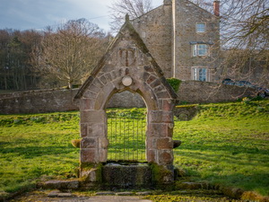
I returned to the main
path then followed it to the old St Mary’s Church down by the river. It
is surrounded by a wall and is long abandoned and in ruins. Apparently
it was dismantled and rebuild in Brignall up the hill.
==
The A History of the County of York North Riding says the following.
The ruins of the old church of ST. MARY, on the bank of the River Greta,
are sufficiently preserved to show that it had an aisleless nave and
chancel, the latter being of the 13th century, about 24 ft. by 12 ft.
There were originally three lancets in the east wall, which in the 16th
century were replaced by a squareheaded four-light window. In the south
wall is a 13th-century piscina, with signs of a widely-splayed window,
which was probably a lancet, though now it has a square head; there are
also some remains of a low-side window at the south-west. The north wall
shows nothing earlier than a 16th-century doorway, but a piece of stone
with interlaced ornament is built into it. A 14th-century grave slab
with a large pair of shears carved on it lies in the chancel.
==
Its replacement church was opened in 1833. |
|
|
|
Original
Church of St Mary |
|
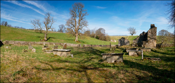
St Mary's and graveyard |
|
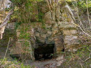
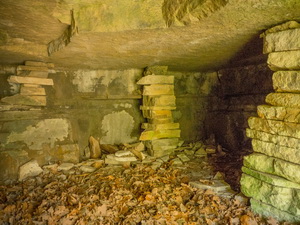
The path then headed into
the woods and was a very pleasant walk in the warm sun. Below Brignall
Banks I came to a small cave on my right. It didn’t go in very far but
had manmade stone columns build inside, presumably to keep the roof up.
There is mention of it in Sir Walter Scots writings.
|
|
|
==
A little above Greta Bridge is the cave where 'Bertram Wycliffe' met
'Guy Denzil' and listened to 'Edmund's' song and the chorus of
revellers.
Poetical works, Volume 5, by Sir Walter Scott
'Oh, Brignall banks are fresh and fair, And Greta woods are green; I'd
rather range with Edmund there Than reign our English queen.'
== |
|
|
|
Brignall
Banks cave interior |
|
|
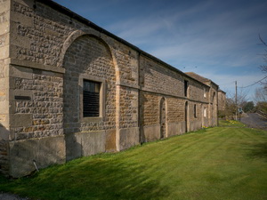
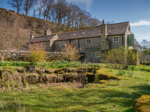
I reached the access road
to Brignall Mill and followed it down to the buildings. They are in very
good condition and seem to be holiday homes. The path is signposted
round the property but it is possible to see the old water routes. After
the buildings I crossed the footbridge over the River Greta then started
to head downstream on the far bank. |
|
|
|
|
|
|
Footbridge over the River Greta |
|
|
I was now on the same
route I’d walked when last here. After half a mile I came to Henning
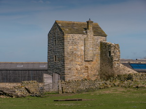
Wood and decided to turn right and follow the path up to Scargill
Castle, which is a converted gatehouse and how a holiday home. I joined
Chapel Lane and past the faint remains of the old chapel to Gillbeck
Bridge. |
|
|
|
Up
through the woods to Scargill
Castle |
|
|
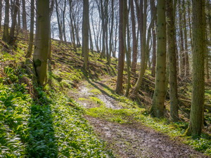
I turned right to head
upstream through the woods. It was a pleasant walk and there were some
interesting wooden footbridges to cross. I left the woods and across
open land to Woodclose Gill. The path crosses the stream here and there
is no footbridge. Fortunately the water was low. |
|
|
The continuing path route
had been diverted and there had been a lot of planting. The diversion
took me up to the track that crosses Scale Knoll. It was unsurfaced and
unadopted to Haythwaite. Here I came to the tarmac and had an easy and
pleasant walk back to my car. |
|
|
|