|
Threlkeld, Blencathra, Scales,
Cumbria.
[12.8 km]
Fri 16 Jan 2015 |
|
|
|
OS Grid Ref: NY 31850
25602
Lat/Long: +54.620942, -03.056943
It was windy and snowing as I drove along
the A66 from Penrith. The car park at Threlkeld was easy to reach and
only had one car on it. It had been there overnight so presumably was a
local’s. I’d originally planned to walk over Blencathra in an
anticlockwise direction but the wind was westerly meaning I’d be into a
head wind along the summit ridge. |
|
|
|
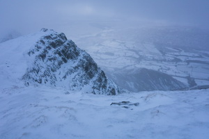
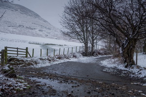
Snowy
view just after the start. |
|
|
I decided to reverse the
direction to have the wind behind me. As I set off up the path the
falling snow became heavier. I turned left at the main path above Blease
Farm and headed west. I couldn’t see the main path up the west approach
to Blencathra so continued on the lower path along the wall. Eventually
I had to leave it and head straight up the fell side to find the correct
path. |
|
|
The snow had obliterated
most of it but I managed to follow it up to the main path and its zig
zag rout up the mountain. Although windy it was an easy steady climb but
the summit weather prospects weren’t good. The wind was very strong and
spindrift whizzed bye. As I walked along the summit I was glad the wind
was behind me. Occasionally the cloud would clear slightly revealing the
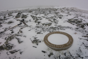
view down to the lower fields. I reached the ordnance Survey trig point
at Hallsfell Top which is of a fairly rare construction. |
|
|
It is a circular concrete
ring at ground level. It was no place to hang around as the temperature
was -6degC and strong winds. I continued east to find the descent path
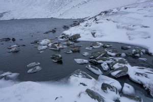
towards Scales Fell. It was very indistinct due to the drifting snow. I
was heading for Scales Tarn but couldn’t see the path as it was under
the snow. |
|
|
Eventually I saw it and
had to traverse the steep slope to reach it. I was glad to reach the
tarn and an easier gradient. Descending the path at Scales Beck I met
two men walking up. There were heading for Sharp Edge which I didn’t
think was a good idea as it is difficult even in good weather. |
|
|
The path above the River
Glenderamackin was a pleasant walk with little wind. I met a few more
people on their way up. Down Mousthwaite Comb I took the lower path back
to Scales Farm and the path following the old road back to Threlkeld. As
I left for the drive home the clouds cleared and I could see the snowy
summit under a blue sky.
|
|
|
|
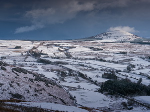
Little
Mell Fell in the distance |
|
|
|
|
|
|
|
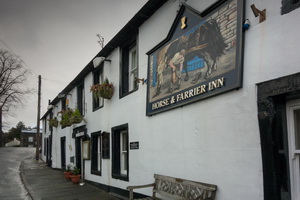
Horse
and Farrier Inn, Threlkeld |
|
|
|
|