|
Ambleside, Lily Tarn, Loughrigg
Fell, Loughrigg Quarries, Cumbria. |
|||||||
|
OS Grid Ref: NY 37118
04449 It was raining when I left home and still raining when I arrived in Ambleside. To the west of the River Rothay is a narrow lane where it is possible to park without restrictions. The only disadvantage is that most people know about it and getting in is difficult during the day. As I arrived about 07:30am there wasn’t a problem. It was just coming light as I set off along the lane for a short way before leaving it to head up a track. |
|
||||||
|
Slabs of stone set vertically in the ground formed the road boundary. The track took me to Miller Brow where a wooden stile took me over a wall and on to a muddy path. I soon left the woods behind and climbed up into the mist and a continuing muddy track. As I got higher the gradient eased but I still couldn’t see where I was. |
|
||||||
|
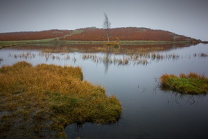
I was heading for Lily Tarn and reached it before realising. On the bank was a wooden bench seat which would be an ideal spot to spend some time, but not today. I headed west through the mist following the path and a wall to my left. At a sheepfold the path headed north but I soon found myself with no path to follow, even though the map clearly shows one. |
|
||||||
|
|
||||||
|
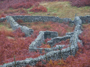
Its not surprising the area is called Black Mire. I scrambled up through wet undergrowth to leave the none-existent path and join one that did exist. After a while I left the path to search out the location on an old back-packing campsite I’d used 10 years ago. With thick mist swirling around there were no views and nothing to see. I pressed on to the summit Ordnance Survey Trig Post then started my descent of Loughrigg Fell to the north west. |
|
||||||
|
|
||||||
|
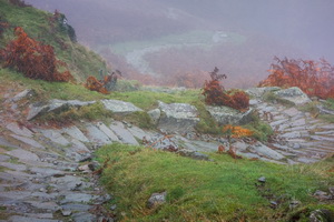
The steeper parts of the path were stone steps following a winding route. Eventually I got some misty views as I dropped below the thick cloud. The main path below had several walkers on it, all well wrapped in their waterproofs |
|
||||||
|
The main path is called Loughrigg Terrace and when I reached it I followed clockwise for a while before leaving it for a rougher path to the old Loughrigg Quarries. |
|
||||||
|
|
|||||||
|
|
|||||||
|
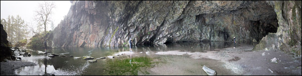
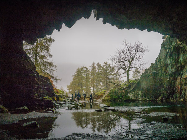
It was a worthwhile detour as there was a huge quarry cave which had a path and stepping stones leading to its interior. Many walkers were about enjoying the splendour of the cave. Back outside I followed a rough and stony track down towards Rydal. As I descended it improved and near the road at Pelter Bridge was a car park. At the narrow road I turned right and walked the final mile or so in the rain back to the car. |
|
||||||
|
|
|||||||