|
Haweswater, Blea Water, High
Street, Kidsty Pike, Cumbria.
[11.2 km]
Thu 16 Oct 2014 |
|
|
|
OS Grid Ref: NY 46947
10737
Lat/Long: +54.489185, -02.820489
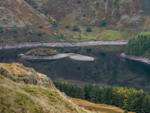
I drove via the M6 and Shap Village to the
south end of Haweswater and the car park. There were two vehicles
already there but nobody about. Both looked like they’d been there all
night. Haweswater is a reservoir feeding water to Manchester. In recent
months the level has dropped considerable due to lower than usual
rainfall. Contrary to recent news reports the low water level has not
revealed the flooded ruins of the village of Mardale. |
|
|

Wastwater from the road |
|
However, it was possible
to see the old walls in the valley bottom. I set off along the path
towards Blea Water. Passing the south end of Haweswater I looked across
the expanse of dry valley that had been exposed by the low water. The
field boundary walls were clearly visible and the lane where the
Gatesgarth Pass track originally reached the Dun Bull Inn could be seen.
The Dun Bull and surrounding properties of Mardale were demolished. I
followed the path up the side of Mardale Beck then Blea Water Beck. The
gradient levelled for a while before a short climb up to the spillway at
Blea Water. |
|
|
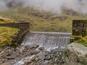
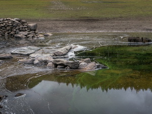
On the way up I’d seen a
partly exposed iron pipe of about 6in dia. I recall that Blea Water was
used for local water supplies but the nearest ‘local’ is several miles
away. The spillway dam is in good condition with some surface valve
lids. When I returned home I was surprised to see that Wikipedia shows
Blea Water having a depth of 63m (207ft) the deepest tarn in Cumbria. |
|
|
|
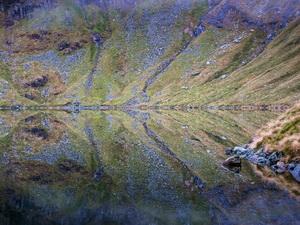
Still
and very deep Blea Water |
|
|
Only Windermere (67m) and
Wastwater (79m) are deeper. It is listed as the same depth as Ullswater.
Looking at its peaceful surface it is hard to comprehend its depth. The
map shows a diagonal path up to Riggindale Ridge. I followed it and
found it surprisingly easy with a steady gradient. |
|
|
|
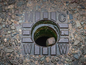
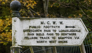
Valve
box MCWW
Manchester Corporation Water Works |
|
|
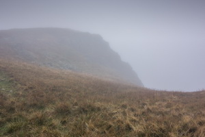
Before reaching the ridge
I climbed into cloud which is what I expected. The track along the ridge
is a bit of a scramble in places but without any exposure. I reached a
cairn then a flat grassy area across to the main stone wall along the
ridge of High Street. Instead of descending to the main path below I
followed the wall north to the Straits of Riggindale. |
|
|
|
|
|
|
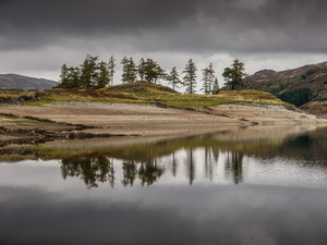
Haweswater below the cloud |
|
|
I took the right trail up
towards Kidsty Pike but still there weren’t any views. It was
surprisingly calm with hardly any wind. At Kidsty Hows I descended below
the cloud and had a nice view of Haweswater and the exposed walls around
its perimeter. I needed to take care on the final steep grassy descent
to Bowderthwaite Bridge. |
|
|
|
Bench
Mark on the exposed bridge |
|
|
|
|
|
The low level of the
water and exposed walls were too good to miss. I stepped over a fence to
walk across the dried muddy reservoir bed. It had been exposed for so
long there were large expanses of grass growing. Several years ago I did
the same walk and found the same stone slab bridge exposed with a bench
mark cut into it. I headed back over the fence and up on to ‘The Rigg’
path. I could see walkers across the valley walking along the exposed
old road the Dun Bull Inn. At the head of the reservoir I rejoined my
original path and returned to the car park, which was no nearly full. |
|
|
|