|
Grimwith Reservoir,
Appletreewick Moor, Hebden Moor, Nth Yorkshire. |
||||
|
OS Grid Ref: SE 05987
63026 Drove via Grassington to B6265 Stump Cross Caverns Road to a point near Grimwith Reservoir. It’s the first time I’ve walked in this area and wasn’t sure of parking availability. I left my car in a dirt lay bye where the map shows a track heading to the reservoir. It was just a farm track but took me to where I wanted to go. |
|
|||
|
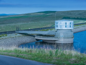
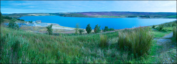
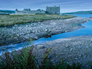
The map shows a car park by the reservoir but no obvious way to drive there. I reached some building then the substantial public car park which had an access road leading to it from the reservoir direction. There was a nice view across the reservoir from a path above the lower road and yacht parking area. |
|
|||
|
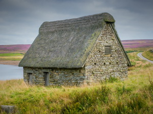
I followed the path just above the reservoir to one of the inlets at Shaws Dyke and Grimwith High Laith where an old barn had been refurbished by re-thatching the roof. It looked quite nice but was locked and didn’t seem to serve any purpose. |
|
|||
|
I was now on the around reservoir track and soon came to the old Farmhouse, Grimwith House. An information board said it was vacated in the 1970s presumably just before they started work on raising the dam. |
|
|||
|
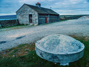
On the north side of the reservoir I left the track and headed north along another track running by a wall. A substantial shooting hut was at the start and nearby a few large circular capping stones, though no evidence of their original use. |
|
|||
|
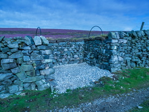
They seem to have been transported here for storage and security. As I walked up the track I noticed the shooting butts were built into the stone wall. It’s the first time I’ve seen this arrangement and they’d done a very tidy job. At Trunla Hill I left the track and went through a gate on my left to follow another wall over Stony Nick Crags. |
|
|||
|
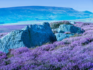
The earlier clear sunny weather had now gone but it was still cloudy bright with hazy views. I reached the steep drop down into Gate Up Gill and could see several feeding trays for grouse. I found a diagonal way down to the gill bottom and could then see the old buildings of the long redundant lead mines. There were long ferns and rough ground up to Tag Bale Hill but nice views from the top. After crossing some rough and wet ground I followed a wall to the Lower Blea Beck Dam. |
|
|||
|
The main dam was breached with water running round the west side. But there was still quite a bit of water behind it. I found a faint path by Blea Beck which became a right of way at the next gate. I followed it across Hebden Moor where I went through a gate into the walled Blackstone Edge Lane. |
|
|||
|
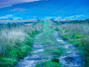
It was a delightful green lane to walk along and I followed it all the way back to the B6265 road. |
|
|||
|
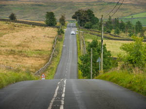
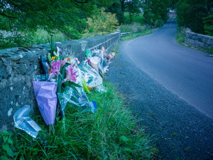
After a steep descent to Dibbles Bridge I stopped to
look at some bunched of memorial flowers and a police sign asking for
information. It appears that on Wed 13 Aug 2014 a cyclist, James Nelson,
collided with the bridge. The ‘Cycling Weekly’ said: |
|
|||
|
Nelson, 32, died of multiple and traumatic injuries to head and chest, a
post-mortem examination found. The final part of my walk was steeply up to my car. It was quite sad though as I was thinking of the cyclist who had died. |
|
|||
|
|
||||