|
Allendale, Stobb Cross, Watson's
Pike, Long Drag, Northumberland. |
|||||||
|
OS Grid Ref:
NY 8375 5583 |
|
||||||
|
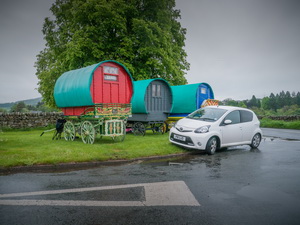
There were several caravans on the outskirts of Alston but all were parked up on the grass verges with no signs of anybody being up. I continued along the A686 to cross the River Allen. There where several horse drawn Gypsy caravans approaching from the other direction. I reached Allendale in pouring rain. |
|
||||||
|
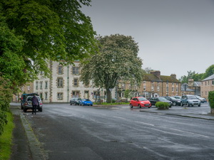
There were plenty of parking spaces in the town centre so I put on all my waterproofs and set off. Before leaving the town I noticed Isaac’s Well on my right. It is a stone water trough with a information plate reading: |
|
||||||
|
 Isaac Holden |
||||||
|
Isaac's Well is named after Isaac Holden (c.1805 - 1857), a local tea
seller who raised the funds for its construction. Fresh, clean drinking
water not only helped overcome the threat of cholera and typhoid but
also made better tasting tea. Although no longer safe to drink from, the
well now lies on the route of ‘Isaac's Tea Trail’, a walk that follows
the tea seller’s footsteps through the North Pennines. There is an Issac Holden article from the Hexham Courant here. |
|||||||
|
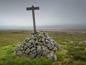
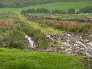
I turned right up the next lane and steeply op to Finney Hill. At the high point I was starting to reach the mist level. Near High Scotch Hall I turned left along a rough and muddy bridleway that headed out onto the moors. At the end of the walled track I went though a gate and out onto a very wet track. After a while I saw a cross on a pile of stones to my left. I investigated and found it to be Stobb Cross, which is marked on my map. The cross was wood and not very old. There was no indication what it signified. I returned to the path, crossed another and continued a mile to an improving track. |
|
||||||
|
|
||||||
|
There was a substantial shooting hut on the left but it was locked. I continued up the track to Hangman Hill then near the summit of Lilswood Moor saw the Ordnance Survey trig post across open moor to my left on Watson’s Pike. |
|
||||||
|
I headed off towards it in light rain, but at least I was just below the mist level. There are no paths of any kind around the trig post. I continued over Watson’s Pike to descent across rough ground to cross the path called ‘Broad Way’ continuing across more rough ground to the track called ‘Long Drag’ I headed north along it to gate where there was a ‘No Access’ sign. |
|
||||||
|
I continued through the gate to join a minor road near Westburnhope. I turned left down the road and over Rowley Burn to follow a steep muddy track up the hillside to Burntridge Moor and Long Rigg. There was nothing of significance to see in the rain so I just plodded on. Eventually I reached tarmac at High Struthers and descended a mile and a half back down to Allendale where it was still raining the same as when I left. Not wanting to get stuck behind a slow horse drawn caravan on my way back I drove the long way round, joining the A69 then west to the M6 near Carlisle. |
|
||||||
|
To |
|
||||||
|
|
|||||||