|
Slaggyford, Knarsdale, West Dun
Hill, Black Hill, Northumberland |
||||
|
OS Grid Ref:
NY 67611 52361 |
|
|||
|
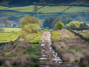
At Knarsdale I came to the bridge carrying the lane to Hanging Shaw. A path to the left connects with the road. But I wasn’t on the tarmac for long. A branch off to the right is where I was heading and it was a walled rough track going up onto the fell. |
|
|||
|
The sun was getting higher and the day was warming up. A man was walking up the lane with his dog. He seemed like a retired farmer and we chatted for a while as we walked up the rough lane. He took a path to the right and left. The track continued in a dead straight line up the valley above Thinhope Burn. |
|
|||
|
The track finished at a gate and I was then on rough ground with only a wire fence to follow. Up ahead I could see a large JCB excavator but it was motionless. When I reached it I could see that it was being used to dig an access road into the area by the opposite side of the valley. |
|
|||
|
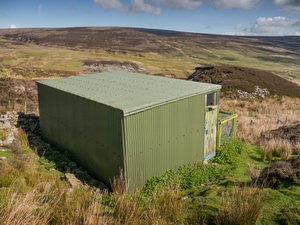
I then headed upwards across rough open ground to another fence which I followed to an old shieling site called Mardy’s Shield. I could see it from a distance and noticed a lot of pigeons around. When I got there I noticed there was no access track to it so it can’t be used as a shelter for the grouse hunters. The whole building was made of corrugated sheeting and the door was only held shut by a rock. |
|
|||
|
Inside were many pigeons and an old chimney stack with hearth. I later found out from a ranger the pigeons are encouraged to breed here as they provide food for the birds of prey meaning there’s a better chance of the grouse being left for the hunters. I followed the continuing fence up the hillside. It was very rough with deep heather and tough going. It wasn’t far short of a mile and seemed to take ages. |
|
|||
|
||||
|
Thankfully on the summit ridge there was a faint path to follow to the left. I also had the bonus of views across into Geltdale and the Cumbrian hills in the distance. I was now on West Dun Hill and headed roughly south to the piles of stones called Hornby’s House. It’s difficult to imagine it ever being a house or shepherds hut. I left the fence and headed east across open ground again. Thankfully the ground wasn’t as difficult as previously and soon I could see my next objective which was a shooters track along the side of Black Hill. I could also see a shooting box building in the distance and one of the wooden shooting butts getting a touch of creosote by a ranger. |
|
|||
|
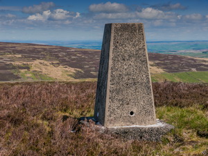
I walked over for a quick chat. He told me about the pigeons being encouraged to breed and provide food for the birds of prey. Once on the stoned track the going was much easier. The weather continued fine and warm. I had to leave the track for a while at Black Hill to climb across more heather to reach the Ordnance Survey trig pillar. |
|
|||
|
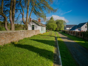
It was a lovely spot to stay a while and use my binoculars to extend my views. The track descended steeply down towards Hanging Shaw but I didn’t go that far but crossed fields to the farm of Knar. I was then on an easy tarmac road all the way back to the car. The stone bridge over Knar Burn was very impressive but there then followed a long climb out of the valley before descending back down to Slaggyford and the car. |
|
|||
|
|
||||