|
Maiden Way, Larchet Hill, Byers
Pike, nr Brampton, Northumberland. |
||||
|
OS Grid Ref:
NY 6657 5876 |
|
|||
|
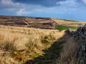
It was of variable quality but the stile fence crossings were all very good with easy access platforms for some of them. It was fine with blue sky at the start but distant views were hazy. As the path descended to Glendue Burn near the A689 the path crossed over the wall via a wooden stile. Unfortunately there was no marker post on my side of the wall and I overshot and finished up at a wire fence barrier. I soon retreated to find the right route. The path climbed for a while then flattened out as it continued along the line of the Roman Road. It was nice to see a plover in the adjacent field swooping around with its characteristic call. Passing through a gate I turned right to follow the wall up to a substantial track heading over Proudly Hill and on to the moor. It must be a shooting butts access track as it only goes as far as Larchet Hill. |
|
|||
|
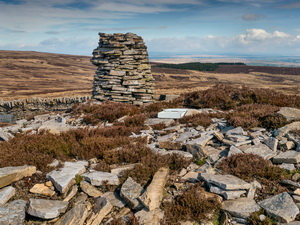
It was easy walking and the views were good, in spite of distant haze. The map showed me passing through the wonderfully named area of The Swangs but I couldn’t see anything that would justify the name. Just over the summit of Larchet Hill the track ends at a turning area with a hut in the corner. All the windows were covered and door locked. One reason I’d come this way was the map showed a chimney. There was no sign of one but a pile of stones and a carn in the middle. There was no sign of any evidence of mine workings so a chimney didn’t make sense. My continuing route was west, following the wire fence line. |
|
|||
|
Up to now the going had been easy but ahead there was no path so I’d have to struggle through the rough ground. At Shivery Break was a small depression where I could shelter from the wind and have my sandwiches. I continued for another half mile then crossed the fence to head due north towards Byers Pike. Earlier I’d seen a Landrover parked in Glen Due but couldn’t see anyone. As I crossed the open fell a man walked up from the direction of the Landrover. |
|
|||
|
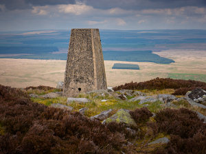
He looked like a gamekeeper as he approached with his 12 bore gun, but no dog. I thought I was in trouble but I’m sure it’s open access land. His concern was that I was lost so after reassuring him that I knew exactly where I was we chatted then continued our separate ways. Over another fence I soon came to the Byers Pike summit Trig Post. |
|
|||
|
I found some shelter to admire the view. It was possible to see all the way to Hadrians Wall to the NE. I started my descent to the west as I wanted to visit the abandoned quarries above Black Burn. Some areas of the fell had been mown in avenues, presumably to make the ground more suitable for the grouse shooting. I was happy as it made for easier walking. I misjudged the direction slightly and finished up traversing some steep ground before reaching the quarries. The quarry workings were quite extensive with a high and very long quarry face. I passed some old brick structures as I joined the access track which had a well-engineered gradient down to the line of the old railway near the current A689. |
|
|||
|
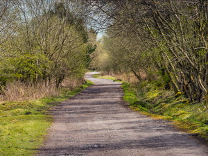
The railway route had been converted to a walking and cycle track and was a delight to walk along. I reached houses and the A689 which I crossed over to re-join the old railway line. It was still a surfaced path and took me to a minor road. Crossing that the rail route continues but the surfaced path doesn’t. It’s signposted as a path but isn’t shown on the map. It went through an area of old abandoned building and mine working before reaching the next minor road and my car. |
||||