|
Hurstwood, Worsthorne, Gorple
Road, Cant Clough, Lancs.
[10.5 km]
Fri 18 Apr 2014 |
|
|
|
OS Grid Ref: SD 88187
31265
Lat/Long: +53.777584, -02.180742
I made a last minute decision to try a local walk this morning. Being
Easter Good Friday and sunny I knew there would be plenty of people
wherever I went. I drove to the car park at Hurstwood near Burnley. The
main reason was that I wanted to investigate an old brick building on
the Gorple Road that John Harrison emailed me a photo. It looked very
much like the control room of a WW2 Starfish decoy site. I reached the
car park only to find it ‘pay & display’. It was empty. The nearby
approach road was quite wide and several cars were already parked there,
so I left mine there as well. I headed back along the road through Hurstwood then took the path across fields to Worsthorne. Part
of it was stone slabs set in the field and these continued by the side
of an old walled lane that went straight to the middle of Worsthorne. |
|
|
Passing St John’s Church I turned right and east along the Gorple
Road. Away in the distance I could see groups of people already walking
ahead in the distance. |
|
|
|
Lovely
house on the Gorple Road |
|
|
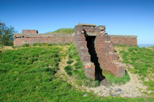
Before I reached the site
of the brick structure I saw two local men by some allotments. I asked
the first if he knew anything about the building. He didn’t but said his
friend nearby Alf Armstrong (Big Alf) would. He did and remembered when
it was a decoy installation during the war. It was partly decoy aircraft
hangers made of canvas which eventually caught fire and burned down and
not as a result of enemy action. |
|
|
|
Starfish
control building |
|
|
I walked up to the brick structure and took some photos
before continuing up Gorple Road to Wasnop Edge where I mad a short
detour to investigate a couple of stone cairn circles shown on the map.
There wasn’t much to see, just some small low stones and a ditch.
Returning to the track I continued up to the east with the many people
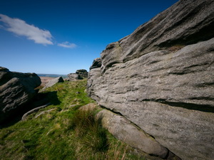
also enjoying the sunshine. At the summit and boundary I turned right
along a faint path to the rock outcrop called Hare Stones. There was
nobody in this area of moor so I stopped for some lunch before following
the line of a path shown on the map down to Rams Clough. |
|
|
|
|
|
|
|
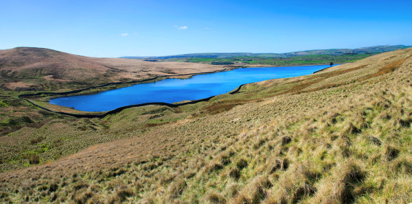
There is no
sign of any kind of the path on the ground. On Hazel Edge there was a
path that I was able to join and follow. It became quite substantial as
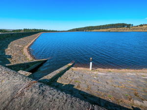
I continued to Hindle Banks above Cant Clough reservoir. It was a
pleasant green lane by the time I reached Hurstwood Reservoir but as I
descended along the track down through the trees there were lots of
walkers and mountain bikers. I was glad to get back to the car. The road
leading away from the car park was now packed with parked cars. |
|
|
|
Hurstwood Reservoir in the sunshine |
|
|
|