|
Wythop Mill, Ling Fell, Kirk
Fell, Harrot, Cumbria.
[15.2 km]
Tue 25 Feb 2014 |
|
|
|
OS Grid Ref: NY 1767 2941
Lat/Long: +54.653059, -03.277517
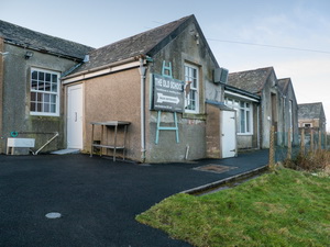
I left my car in the parking area a short way down the road from the
Wythop Old School. I set off up the road by the School building and had
a quick look as I passed. It’s not used as a school anymore but seems to
be some sort of outdoor centre.
An on-line search revealed:
Embleton and
Wythop Old school (situated in Wythop Mill, in Embleton township)
educated the children of the two townships from 1808 until its closure
in 1978. |
|
 |
|
Wythop Old School |
|
|
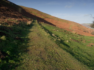
Continuing up the road
for about half a mile I took a sharp right through a gate to follow the
green track that is called the ‘Corpse Road’ on the map. I was walking
along the north slopes of Ling Fell and soon left the main track to take
a left branch which headed up the main part of the Fell. The last part
of the climb was on a faint path. Up ahead I could see a man walking
towards the summit. We reached the summit trig post about the same time. |
|
 |
|
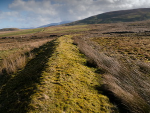
The Corpse Road |
|
|
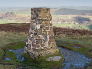
He reached the summit,
turned round and headed down straight away. He didn’t even stop to look
at the view and hardly acknowledged my morning greeting. I stayed a
while and had difficulty standing in the fierce wind. I started my
descent to the SW and headed for the fence that followed steeply down to
Bladder Keld Spring. |
|
 |
|
Ling Fell trig post |
|
|
Ahead I could see the
next part of my route across Wythop Moss. The name indicates a boggy
area but as it turned out it wasn’t too bad underfoot. The Blader Keld
spring is fairly insignificant and just below is Tom Rudd Beck. I
followed the straight fence line towards the distant Graystones and Kirk
Fell. |
|
 |
|
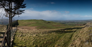
View to Graystones
and Kirk Fell |
|
|
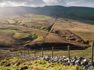
On the way I walked round
the grassy embankments of an old reservoir that is shown on the map.
There is no water in it now as the lower embankment is breached. As I
got higher the wind became much stronger and by the time I reached a
small cairn on Graystones I could hardly stand. I sat behind it to try
and get some shelter and tried throwing a stone in the air to see what
happened. I was amazed to see the wind throw it higher and a
considerable distance to the north. |
|
 |
|
Embankment of old
Reservoir |
|
|
I skirted the north side
of Kirk Fell to try and get out of the wind as soon as possible. A stile
took me over a wire fence where I started a NW descent towards my next
objective of Harrot. I reached a track above Tooth Haw Plantation and
followed it to a gate. Harrot was visible to my left but also visible
were rain clouds coming in on a very strong wind. |
|
 |
|
View to Harrot |
|
|
Crossing towards the
summit I had to cross some very wet ground then decided to head for the
shelter of a plantation of trees on my left. They did the trick and I
got out of the wind and rain for a while. Harrot summit was very windy
but I got over it with the wind behind me. |
|
 |
|
Long walk to High
Side Farm |
|
|
After a steep descent I
was on a farm track then down to the road. I had almost 2 miles of road
walking to get to High Side Farm then it was down a track towards St
Cuthbert’s Church. |
|
 |
|
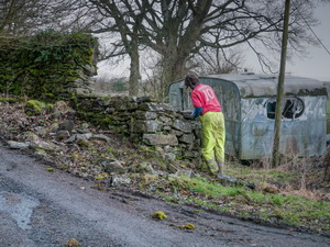
Wall repairs near
High Side Farm |
|
|
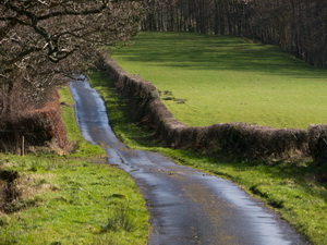
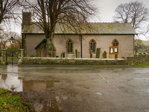
It began raining again as
I wandered down the lane but at least the Church was open when I got
there. The existing building is from around 1813 and was probably built
on a much older site. The rest of the walk was along the road in the
rain but fortunately not much traffic. |
|
 |
|
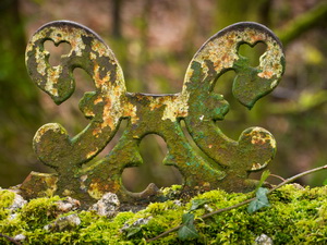
Bridge parapet
detail near Laurel Bank |
|
|
 |
|
St Cuthbert's
Church, Embleton. |
|
|
 |
|
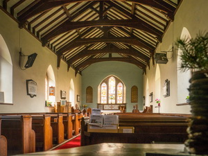
St Cuthbert's Church
interior. |
|
|
|