|
Cowshill, Burnhope Reservoir,
Green Laws, Wellhope Burn, River Wear, Co Durham. |
|
|
OS Grid Ref: NY 8542 4062 |
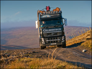 Logging lorry |
|
I left the road and turned up the track to the right. There were fresh vehicle tracks as I walked up towards the trees. I gained altitude and was soon above the pines and looking down on the reservoir. I could hear vehicles somewhere in the trees as forestry work was going on. |
 Logging lorry |
|
A Northumbria Water land rover appeared ahead and drove past me. In the distance I watched a fully loaded logging wagon approach and pass by. Further on were a very large pile of freshly cut logs and the lovely smell of freshly cut timber hanging in the air. |
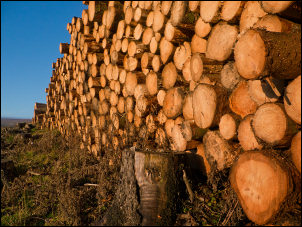 The smell of cut timber |
|
There was a gate though a wall and to the right a boundary marker post saying D. C. W. B. Boundary. Presumably Durham County Water Board. I followed the wall up the hillside, passing an old railway carriage being used as a shed. Higher up I could see some rocky outcrops and headed for them in the hope of finding some shelter from the wind to eat my butties. When I got there the views were good but there was no shelter. |
 D. C. W. B. Boundary. Presumably Durham County Water Board. |
|
I headed across Green Laws where I found some large sink holes and found some shelter to have my lunch. I continued along an indistinct track towards the summit ridge and the trig post. I missed seeing the feature the map calls The Malakoff. I wondered if it referred to the 1855 Battle of Malakoff during the Crimean conflict. The trig post was windy but I still had good views. |
 Trig post near Highwatch Currick |
|
I crossed the wire fence and started my descent to the north. The ground was rough but not too bad as I was descending. The map shows a large area of Pine woods but they had been felled. I picked my way through the stumps to check out an old mine heading then followed the contour to Lamb’s Hill. I was soon following an old leat or waterway. It took me to an area of old mine workings with a ruined building by Wellhope Burn. One doorway and access steps were still standing. Across the river I walked up to an old track where there were a couple of wooden shooting huts. The track continued east through a large area of land that had been cleared of its trees. The path turnoff to Wellhope wasn’t marked and I overshot it before realising my mistake. I returned and took the path. It’s no wonder it wasn’t marked as there is no sign on the ground. |
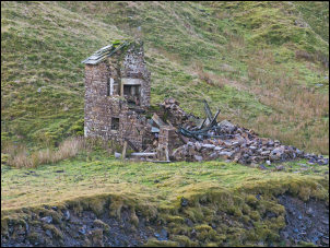 Wellhope Burn mine building |
|
At Wellhope bulidngs I rejoined the track and continued to Killhopeburn bridge where I followed a better path across fields. I was heading downstream towards Hetherycleugh. Before I got there I came to an area of landslip where a ‘path closed’ sign had been placed. No diversion was indicated. I ignored it and walked round the landslip and down to Heathery Cleugh. Over the footbridge and through someone’s garden I crossed Heathery Bridge and continued downstream along a pleasant path through fields to the old flooded quarry near Cowshill. After having a quick look at the quarry I returned to the south bank and followed a couple of fields back to Burtreeford Bridge and back to the car. |
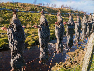 Mole near Killhopeburn bridge |
|
|
|