|
Galligill, Nentsberry, Middle
Fell, Alston Moor, Cumbria. |
|
|
OS Grid Ref: NY 7590 4471 |
 Haggs Mine buildings and old mine level |
|
It’s always difficult with these places to figure out if they’re proper farms or just private houses. There was no sign of a path down to Low Galligill and I had to search for it through the pines. I had to do more searching at Island Cottage to find where the path connects with the track. I crossed the River Nent. The track continued past the Caravan Park and joined the main A689 at the old Haggs Mine buildings. An old mine level emerges by the road with a considerable amount of water issuing from it. Across the road and up the track I continued past Nentsberry buildings and across fields to High Nentsberry. The footpath markers weren’t too clear and I had to make a short diversion to rejoin the path. Approaching Nether Nentsberry I stopped to chat to a couple of men rebuilding the dry stone wall. |
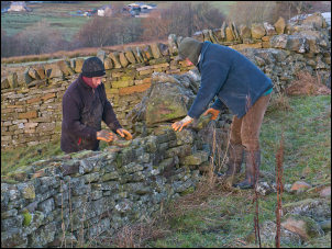 Wall re-building |
|
It was quite chilly and they were well wrapped up. When I reached the Nether Nentsberry farm buildings a man was sweeping up cow muck from outside the barn. The farm house was quite dilapidated but it seemed to be where he lived. We had a brief chat and he told me it dated back to the 16th century. He also told me about the old mine drainage tunnel from Alston to Nenthead. He had a long beard but didn’t speak with a local accent. |
 Lipton's Teas on a gatepost. The path is also part of Isaac's Tea Trail |
|
Across a wet field I
descended back to the main A689 road at Nenthall Bridge. At the road
junction was the Nenthall War Memorial. I now had to walk along the main
road for a mile or so but fortunately there wasn’t much traffic. |
 Nenthall War Memorial |
|
My map didn’t show any paths heading up on to the moor so I went through a gate and decided to follow the wall line that runs up Alston Fell towards the summit trig post. |
 Heading up Alston Moor |
|
The first part was straightforward but soon I had to make a wide detour because of very tall rushes. Things improved after that and when I reached Middle Fell there was a lot of evidence of old mine workings and shafts. Nearby was deep valley which the map calls Redgroves Hush. |
 Redgroves Hush. |
|
I reached the summit Trig Post and had reasonable views but some low cloud obscured some hills. Nearby was an unusually shaped limekiln. My descent was down Galligill Burn but it wasn’t straightforward. |
 Summit trig post |
|
|
 Rockley ruin |
|
Lots of rushes and very wet ground made it difficult in places with detours. Near the end of my walk was the ruin of Rockley which seemed have been an old mine building. Down the field the wall was easy to climb over and then I was back at the car. |
 Haggs Mine old workings |
|
|
|
