|
Nenthead, Knoutberry Hill,
Killhope Cross, Black Hill, Cumbria |
||
|
OS Grid Ref: NY 7810 4365 |
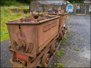 Lead Mine Heritage Centre |
|
|
My first objective was to walk along the line of the old flue which runs up the hillside to a remote chimney. The first part of the line is not very obvious. As I’d seen a couple of others in other parts of the country I knew what to look for. The stone built flue would have been a tunnel sunk part way below ground level. A line of rubble marked it and probably due to the lead debris there wasn’t a sign of growth on much of the debris, not even a blade of grass. |
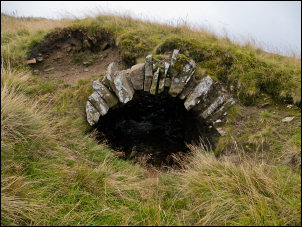 Part of the old flue |
|
|
As I got higher and further from the village I came to some stretches where the tunnel was still intact and I was able to poke my camera inside and take a few photos. |
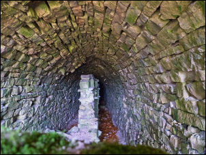 Inside the flue |
|
|
I reached the site of the chimney. The base structure was still there
but the chimney had long since fallen over. Its remains were lying on
the ground and the interesting thing was that it had been built of brick
on a stone base. |
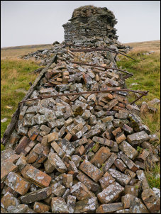 The old chimney |
|
|
I climbed up to visit the cross on its base. Either side were short stone stumps which may have had crosses on at one time. I continued to the summit wall then turned NE to follow it to Knoutberry Hill. There was no path but the ground wasn’t as bad as I’d expected. I was also following the county boundary between Cumbria on my left and County Durham on my right.
|
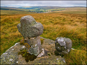 Cross between Nag's Head and Nenthead |
|
|
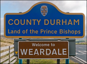
After a mile I reached Killhope Cross on the A689 road. At 623m (2044ft) this summit is the highest ‘A’ road in England. Across the road I came to the actual Killhope stone cross. It was right by the road and I must admit that I hadn’t noticed it before. I continued north following the fence line. The fence turned to the left and left the line of the county boundary. |
 Killhope Cross on the A689 road |
|
 Welcome |
 post marked ‘C 1863’ |
|
|
The spot was marked with a stone post marked ‘C 1863’ I followed the fence for a while then left it to head across open moor to regain the county boundary. The map doesn’t show a fence but there were old rotting fenceposts along the boundary line. My next objective was the three county boundary junction. I visited it last year a soon found the spot where 3 old lines of collapsed fence met to mark the junction of Cumbria, County Durham and Northumberland. A small pile of stones marked the spot. I turned west across some old workings and reached the road. |
 Three County boundary |
|
|
Over the road and in a field was a drilling rig and two men working. I went to have a look and they said they were doing a trial bore for lead and zinc. I continued along the old track to the west which descends into Nenthead. Near the bottom was a terrace three houses. They were new and occupied now but were under constriction when I was here in July 2012. I soon joined the minor road which descended into Nenthead village and back to the car. |
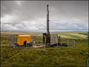 Drilling exploration |
|
|
|
 Under construction July 2012 |
|
|
|
||
