|
Garrigill, B6277, Tyne head
trail, Calvert End, Noonstones Hill, Cumbria. |
|
|
OS Grid Ref: NY 7447 4155 |
 Garrigill Village Hall |
|
Looking over the right hand bridge parapet I could look down to the River South Tyne and also some levelled areas that seemed to have access from an adjacent garden. Straight over the bridge is a steep path upwards which I followed. It was wet and slippery in places and half way up to the main road was a holiday cottage on the left which only had a steep rough unmade track for access. |
 This looks like a garden feature below the bridge |
|
It’s not a track I’d risk my car on. A little further up I came to the tarmac road which was still steep but had a good wearing surface. I reached the main B6277 and turned right for an easy walk to the south. It was warm but quite overcast with the threat of rain. Across the valley to the right I could see the fell I was going to be walking over. After a mile I reached Ashgill Bridge which is much larger than appears as you drive over it. A long way down below is Ashgill Force. The stone information plaque on the parapet reads:
|
 Steep path up to the road |
|
After the last house on the right I came to the footpath sign that pointed me down across fields. The grass and rushes were horribly wet and the route was just a rutted track. As I reached Hole House Farm the path wasn’t very obvious. The path sign pointed into the field on the right but I had to negotiate an unsigned gate to get into the farmyard. It was well maintained but I couldn’t see anyone around. Over the bridge I walked up the track to the tarmac road at a sharp left turn. |
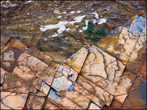 Interesting riverbed pattern near the source |
|
I headed south for a short way where the tarmac finished but a track continued. The sad looking crumbling farm of Dorthgill was on the left. The roof was still on but was sagging alarmingly. The track was well maintained and substantial bank stabilisation works had been done to stop it washing into the river. A vehicle had driven past me earlier and later I saw it parked in the Moor House area which I visited on 26 June 2012. As I approached the high point of the track there is a monument to the source of the South Tyne River on the left. By it is a marker stone which reads:
|
 Source of the River South Tyne |
|
The infant river South Tyne runs north to reach the River North Tyne
near Hexham where they combine to form the main River Tyne which runs to
Newcastle and the North Sea. |
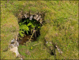 The old mine 'level' |
 Old mine shaft by the 'hush' |
|
|
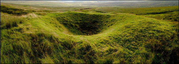
The ground was now getting very rough and wet. I headed up to an old ‘hush’ which is where the surface spoil was removed by a water dam which was filled then released to scour the surface to expose lead ore. It was huge and impressing and had old mine shafts on the north side. I was now on Calvert End and came to a rough track which I soon had to leave to head towards Round Hill and the junction of 3 walls. The weather was deteriorating and the rain became heavier. |
 The old 'hush' with the Radar Station on the distance horizon. |
|
I followed the summit wall to the north and came to a gate which I passed through to take a quad track on the west of the wall. |
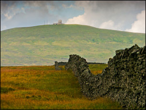 Great Dun Fell Radar Station from Calvert End |
|
It didn’t last long before running off in another direction. The ground improved a bit at Noonstones Hill then I descended towards Paper Hill and a line of shooting butts. |
 Noonstones Hill cairn |
|
To the north of Paper Hill the ground was so bad and wet I took a short cut across by Linkinhow Syke to a track at Green Hill. I followed it to the right where it joined the tarmac road near Howgillsike. I followed it down towards Garrigill but stopped briefly at Crossgill Bridge to look at the marker stone on the parapet which reads:
|
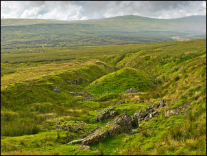
 View from the track |
|
|
 Garrigill Post Office interior |
|
Back in the village I saw the Garrigill Post Office was open. I was intrigued so had a look inside. It was fairly old fashioned with a flag floor. |
|
