|
Mungrisdale, Bowscale Fell,
Bannerdale Crags, Cumbria. |
|
|
OS Grid Ref:
NY 3648 3001 |
 St Kentigern from Raven Crags |
|
Unfortunately it was locked so I hoped they’d open it later in the day. I wanted to make a direct ascent of Bowscale Fell directly from the village but no path is shown on the map. I could see what looked like a path higher up Raven Crags but there didn’t seem to be one lower down. Behind an old small quarry there was a sheep track heading up the way I was heading. I followed it and it eventually became a proper path. |
 Bowscale Tarn from Bowscale Fell |
|
Higher up the path levelled off and the ground was still firm and dry. I wanted to get a view of Bowscale Tarn below but had to descent for a while to get it. Then it was back up to rejoin the path to Bowscale Fell summit stone shelter. I continued south towards Bannerdale Crags but after a while the path became rather indistinct. It became more defined as it traversed the top edge of Bannerdale Crags. |
 Looking down into Bannerdale |
|
On the summit it vanished completely. My plan was to descend White Horse bent to the SE and join the main path by the River Glenderamackin. I’d assumed there wouldn’t be a path but today is the first time on the Cumbria fells with Open Street Maps loaded on my Garmin GPS. The map showed a couple of paths descending the way I wanted to go. I was near the first one so navigated my way over to it. |
 Glenderamackin |
|
There was no sign of a path on the ground. So I headed for the second path shown and there was no sign of that either. I gave up and picked my own way down to the main path. As I descended to the north I met the first people of the day. The path was well engineered though had a lot of standing water in places. |
 Mungrisdale Recreation Room |
|
It would probably have been the main access track to the Lead Mines
further up the valley. After the wooden footbridge I was back in
Mungrisdale. Although there would have been parking available near the
call box there is a request for £2 to do so. At the Recreation Room
there was also parking available opposite, but that was £2 as well. |
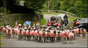 Slow road users |
|
|
 St Kentigern Church interior |
|
|
|
