 Return to
Whittle Wanderer
Return to
Whittle Wanderer|
Wasdale Head, Lord's Rake, Sca
Fell, Hard Rigg, Bulatt Bridge, Old Corpse Road, Cumbria. |
|
|
OS Grid Ref:
NY 18686 08565 |
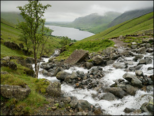 Crossing the gill with Wast Water in the background |
|
The crossing was just about doable without resorting to wading. Normally it’s quite easy but the higher river level meant stepping on the tops of boulders. Brown Tongue had quite a good stoned path heading up its south side. I was soon in cloud and all views vanished. My first objective was to find the narrow entrance to the steep gully known as Lord’s Rake. There is no defined path due to steep and very loose scree. With no visibility I had to use my GPS to leave the easy stoned path and wind my way up the very steep and horrible scree. Eventually the tall rock face loomed up ahead. I could make out the gap that was the entrance to the gully and was pleased to see that the ground was more stable and much easier to climb. When I passed some years ago there was a sign saying not to climb this way due to a dangerous boulder wedged higher up in the gully. I couldn’t see any sign of it now. I found the best way of climbing was to take the right side of the gully and use hand holds on the rock face to help me up. There wasn’t any chance of falling off but there was a chance of stuff falling off and on to me from higher up. Eventually I could see the large boulder up ahead. It didn’t look too unstable and in Victorian times it would probably have been on the list of things for tourists to visit. Instead of crawling under it I climbed over to the right. |
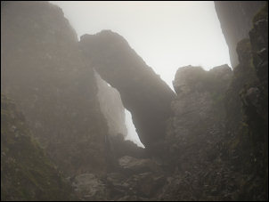 The hanging boulder in Lord's Rake |
|
Over the top the path descends for a while before the last stretch through the gully which is another, but easier, climb. Once out of the gully a stoned path runs up Sca Fell crag to the summit area of rough and large boulders. The temperature had dropped to 10degC and with the combined wind and cloud made it feel quite cold. There is no trig post to mark the summit, just a small cairn perched on top of a boulder. Navigation was very difficult without any view or defined paths. I sheltered behind a boulder to eat my sandwiches then set off to find the route south to another high point on the summit. I came to the Foxes Tarn path then climbed up again to the stones marking the helicopter landing area. |
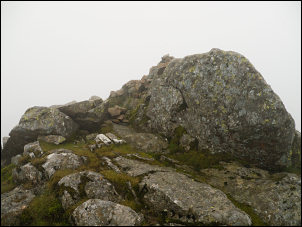 Sca Fell summit |
|
Continuing to the south I came to the path heading down to the west, which is where I was heading. The map seems to show the true summit was in this area and about 4m higher than the small cairn I’d seen earlier. In thick cloud it wasn’t possible to verify any of this. The steep path down was generally quite good but very loose in places. It was so nice to see some grass below as I eventually left the stony area behind. I now also had a view to Burnmoor Tarn and Wast Water. |
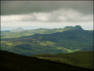 Descending below the clouds |
|
As I continued my descent the grass became very wet indication the area had had a lot of rain recently. |
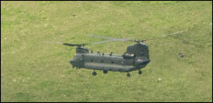 Chinook helicopter on manoeuvres |
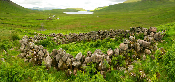 Sheepfold on the approach to Burnmoor Tarn. |
|
|
I could see the path crossing the flat area towards Bulatt Bridge and wondered how wet that length would be. There were some very wet areas to cross but non were in danger of going over my boots. The bridge is now perched in the middle of the river with stepping stones at one side. Presumably erosion had widened the river which is the outlet of Burnmoor Tarn. |
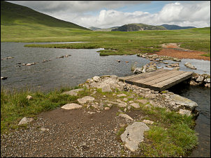 Bulatt Bridge |
|
There were a lot of people about, presumably mostly coming up from Wasdale. I tuned right to follow the path to Wasdale. The odd thing is the path is generally known as the ‘Old Corpse Road’ even though it’s a path. The 1:50k and 1:25k maps I have don’t give it a name. The only map I know that does is the large scale 1:10k map. I made a short detour off the path to visit the ring circle that the map calls Maiden Castle with an ancient cairn marker next to it. |
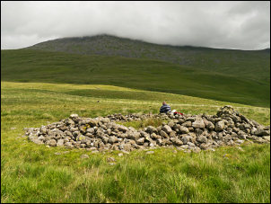 Maiden Castle circle cairn |
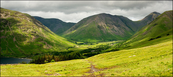 Approaching Wasdale on the Old Corpse Road |
|
|
It was definitely worth the visit but the path back to the main path was horribly wet. As I descended there were a lot of people walking up, some with loaded rucksacks for camping. I passed Brackeclose and continued to the road where I turned right and back to the car. When I got back to the Green there was a farm tractor unloading plastic covered bales of hay from a lorry and placing them on the green. I’m not sure if it was just for storage or to prevent people parking. |
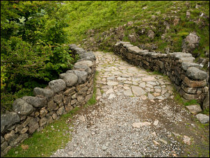 The Old Corpse Road |
|
|
|
|
|
|