|
Rookhope Chimney, Redburn
Common, Bolt's Law Incline, Rookhope, Co Durham. |
|
|
OS Grid Ref: NY 9242 4301 |
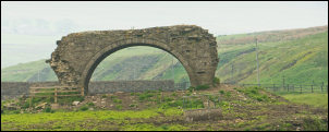
 The last Rookhope Arch |
|
|
 Start of the Rookhope flue |
|
The tunnel is marked on the map as Rookhope Chimney (course of) and my next objective was to follow it up to its termination point. There was no marked path but after a short scramble up a grassy bank and I was level with the top of the flue arch. The tunnel has long since been demolished or collapsed. The gasses came from the Lintzgarth Smelt Mill across the river which dates back to the 1740s. There is no sign of it now. As I walked up the line of the flue I came to occasional building ruins by access points into the tunnel. The records show these were to send boys in to scrape lead deposits off the tunnel walls. |
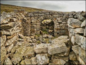 Flue access building |
|
Water would be diverted down the tunnel to wash the scrapings into a tank at the bottom of the hill. The tank used to be where the car park is now. I reached the top and the ruined base of the chimney, though nothing suggests it ever was a chimney. I was now on Redburn Common with lots of flat featureless moor around. |
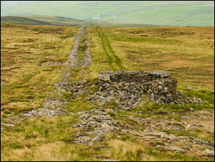 Line of the Rookhope flue |
|
The hazy weather meant I didn’t have much of a view. I set off NE to follow the line of a fence and hoping to find a path that’s shown on the map. I couldn’t find any sign of it but following the fence wasn’t too bad. The strange thing is that in the distance I saw a trig post which is shown on the 1:50k map but not the 1:25k one. Further on I’d still not seen any sign of a path so I made a straight line across wet moor to the road below Cuthbert’s Hill. Across the road a bridleway was marked but there was little sign on the ground. For a long way it was wet rushes underfoot but by the time I’d reached the fence and a gate things were much drier. |
 All that's left of the actual Rookhope Chimney |
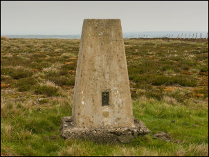 Trig post that is on one map and not another |
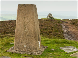 Bolt's Law trig post and currick |
|
At Bolt’s Law was another O.S. trig post but this was marked on both map scales. Nearby was a currick and adjacent a flat stone with miner’s carvings. The most prominent said H.R 1865. |
 H.R 1865 |
|
Descending to the east I saw a substantial old chimney to the NE. I wasn’t going that way but turned south to reach the line of an old railway line. As I walked along it’s well engineered construction was evident. The gradient was levelled by parts raised on fill and some in cutting. Reaching the top of Boltslaw incline I stopped to look at the substantial stabilised ruins of the original winding station. |
 Boltslaw Incline Winding Station |
|
Later in the day I found out more about it by visiting the Allenheads Heritage centre. The descent to Rookhope was down the original incline which was very well made and easy underfoot. In the village I turned right and followed the road the short distance back to the car.
|
 Rookhope village |
 Colour in Rookhope |
|
 The solitary Rookhope arch. |
|
|
|
|
|
|
|
|
|
|