|
Bakestall, Skiddaw, Dodd Wood,
Cumbria. |
|
|
NY 2360 3099 |
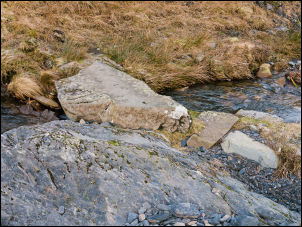 Stone slab across Chapel Beck |
|
I followed a faint track which took me to an interesting stone slab across Chapel Beck but after that I had to cross some rough ground before joining a fairly well defined path up above the sheepfold. The centre of the gill is dry even though the map shows it as running water. The continuing path then becomes narrow and steeper as it climbs towards Broad End. I came to a well used path coming up from the left. I turned right and followed it upwards. This turned out to be a mistake as it took me much higher than I wanted to be. I wanted to check out an old mine by Bead Beck but as I got to the higher area of Broad End I realised the mine was way below. I had a long descent which I’d have to climb up again. When I got down to the where it should be I couldn’t find it. I’d tried before in 2010 and failed to find it. |
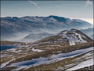
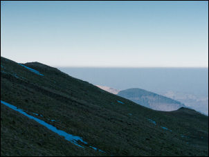 Hazy view to the west |
 Wide view of Ullock Pike and Skiddaw to the left |
|
|
The river was at the bottom of a deep ravine and it may have been at river level. I’ll have to return sometime and walk up the opposite side of the river. I followed a path directly up to Bakestall and its low stone cairn. The sky was still clear but the lower levels were fairly hazy. I followed the fence line up towards Skiddaw summit. There were some shallow snowfields around and as the snow was hard and slippery I decided to make minor detours to get past. I had ice studs for my boots but they were in my pack. As I approached the summit I met the first walkers of the day as they descended. |
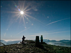 Summit of Skiddaw |
|
|
 From Skiddaw looking south |
|
The earlier cold wind had died down and it felt pleasantly warm in the sunshine. On Skiddaw summit there was much less snow than I expected. The views to south across Derwent Water and the far hills were very impressive. There was still a haze hanging in the air so the mountains didn’t show much detail. I headed south and took the steep descent to Carl Side. There were now many people about both descending and coming up. I followed the steep path down to White Stones then right to follow a minor path towards Dodd. |
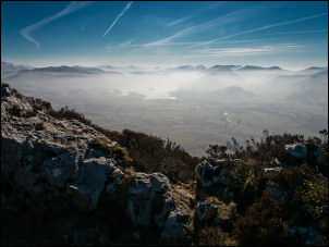 From White Stones looking towards Derwent Water |
|
Over a wooden stile I was on a stoned forestry road. I headed NW and took the first right fork into the trees. Rout finding is difficult as the map doesn’t always agree with the tracks on the ground. I was now in the trees and at one point the track suddenly vanished and became a narrow path along a fence. Eventually I rejoined a track and back to a sharp left turn and down a path to the road. I was at the Ravenstone Hotel and a sign said I could walk along their access roads to avoid the main road which has no path. However, once back on the road there still wasn’t a path and I had to listen carefully for approaching vehicles. I reached High Side cottages then up the minor lane back to the car. The parking area was now full. |
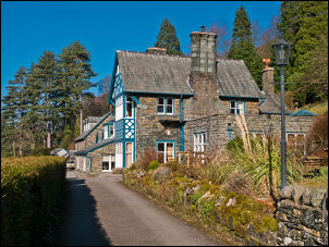 Ravenstone Hotel |
|
|
|