|
Dufton, Harbour Flatt, High
Cupgill Beck, High Cup Nick, cumbria |
|
|
NY 6890 2509 |
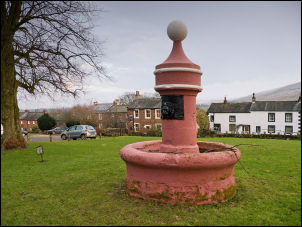 Dufton Green and the water fountain |
|
On the corner is a pole with a red flag on it. It means that public access is not allowed on certain parts of the fell due to Military exercises. I’ve never seen the flag not flying so I think they just keep it up there all the time to cover themselves. Further along the road I took the minor road to the left and headed towards Keisley. It was difficult walking as the road was covered in ice and I had to keep to the rough grass verge most of the way. |
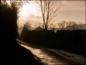 The lane near Keisley |
 High Cup Nick |
|
|
I was heading for the valley approach up High Cup Nick and needed to leave the road at High Cup House. When I saw the sign ‘High Cup Winery’ I wrongly thought that was my turn off. I headed up a farm track towards the fell but couldn’t make sense of the wall layout. When I realised my mistake I returned to the road and continued to the correct turn off. Up the farm track and before the main farmyard is a path signpost to the left. It follows a winding farm track though fields to the bottom of Trundale Gill. I hopped across the stream and continued steeply up the winding track to a point below Middletongue Crag. The map shows a path running high along the valley side but as I tried to find it there was no sign on the ground. I had now reached the snow line and although it wasn’t deep there was a lot of wind about. Rounding the corner I could see well into High Cup Gill with its steep sides. It was too steep to walk along so I had no choice but to descent diagonally to the valley bottom. |
 Snowy traverse on High Cup Nick |
|
I reached it at the line of and old stone wall. On larger scale maps it is shown as a dash line, almost exactly the same as a path. My Garmin GPS has Topo maps loaded and the wall line is clearly labelled as a path. The head wind was making the going tough. I could see the snow plastered rocks of High Cup Nick ahead but is seemed to take ages to get there. I took advantage of some shelter behind a large boulder to have my butties then continued into the wind. The climb up wasn’t as difficult as it looked from a distance. Near the top there was a nice traverse in deep snow which took my up the final gully. As soon as I got on the summit plateau I knew I had to get down as soon as possible as it was very difficult just standing up. |
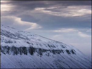 Middletongue Crag |
|
|
 Sheep at Low Pots |
|
The good thing was that I descended by the main path along the NW edge of the valley and I had the wind behind me. The snow had obliterated the path but quad bikes had been up and left their trails. Some sun began to shine through at times but it remained cold. I hadn’t seen any walkers all day but as I walked down the walled track near Dod Hill a farmer and quad bike came by. Shortly afterwards there was another. Back in Dufton the weather had brightened up a bit. |
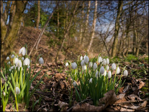 Signs of spring |
|
The top of the water
fountain has an interesting latin inscription. Dufton was mostly built
by the Quaker owned London Lead Company in the 18th an 19th centuries.
Piped water was introduced my them and the fountain inscription
translation reads: |
 Dufton fountain |
|
|
|
