|
Duddon Bridge, Frith Hall, Ulpha,
Hare Hall, Stickle House Barn, Cumbria. |
|
|
SD 1989 8855 |
|
|
|
 Duddon Furnace. |
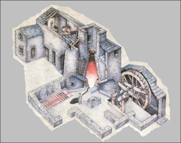 How the Furnace used to look. |
|
|
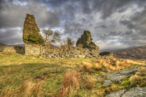
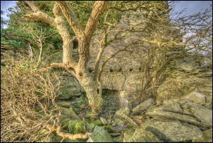
Thankfully by the 19th century furnaces began to use coke so this one went out of use enabling some trees to remain in Cumbria. I continued up the lane which had a surprisingly large number of cars whizzing by. I assume they’re commuters heading for the coast. Over the cattle grid I took the minor road to Logan Beck Bridge. Through a gate to the right I followed a wet track through Ulpha Park. It was plantation to the left and open fell of Penn to the right. For a while I went through woodland on both sides then emerged into open ground and a good view of my next objective, Frith Hall. The main hall stood as a relatively large ruin but next to it was large barn which was being extensively renovated. Lots of scaffolding was up to enable a new roof to be put on. It appears that the main hall was build in the 16th century and there are some references to it in history. One I like is “Frith Hall, now a farm house, was formerly an inn, at which the minister married seventeen couples by the fire side in 1730.” The fireside and large part of the stack is still intact. |
|
 |
|
|
Two views of Frith Hall |
|
|
The photo on the right is where: |
 |
|
|
|
 Descent to Bleabeck Bridge. |
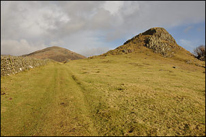 By Castle How and Millbrow. |
|
The continuing track down was now rough and wet as far as Bleabeck Bridge but then it emerges into a wonderful pasture and green track by Castle How and Millbrow. I rejoined the tarmac road and descended to Ulpha and over Ulpha Bridge. |
|
 Walled enclosure of the Friends Burial Ground. |
I took the left track up to Birks where the tarmac stops and I entered Birks Wood. As I emerged I made the mistake of continuing straight on towards New Close but soon realised my mistake and returned to find the correct rough track to the right. Ahead was a clump of trees and a walled enclosure. This was my next objective and is a Friends Burial Ground (Quakers). |
|
There was no sign or any indication of what it was. Only the large scale OS map (1:10k) names it as a burial ground. There was enough shelter behind the wall to make it pleasant in the sun so I stopped to have my lunch. The track continued NE with lovely views up and across Dunnerdale. Through Far Kiln Bank Farm I reached the road again and tuned right up to the summit and small car park. Not far down the other side I saw a narrow miners track climbing up to the right. I followed it towards Stickle Quarries but soon descended again to the main path above Hoses. The path follows the wall, passing Hare Hall then more open ground towards Scrithwaite. |
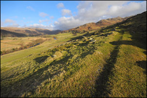 Approaching Far Kiln Bank. |
 Stickle House Barn. |
I joined another green track where a party of walkers were just ahead of me. Soon I was at my next objective, Stickle House Barn. It looks like a fairly inconspicuous barn but inside reveals an excellent example of 17th century cruck-framed construction. |
|
It was grade 2 listed in
March 1990. The listing describes it as: |
|
|
|
|
|
I stopped for a while to take a few photos then continued on then left to follow the path to the buildings of Hawes. I was now on a minor road which I followed all the way to Lower Beansley. A lovely track continued through the woods below Beansley Bank. At Bank End the track took a steep series of ziz zags down to the road and buildings at bank End. I was soon back at the car. |
 Window in a gate. |
|
|
|