|
Threlkeld, Scales Tarn,
Blencathra, Cumbria. |
|
|
NY 5185 2561 |
 the old road between Penrith and Keswick |
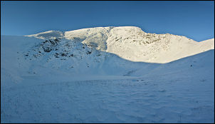 Scales Tarn under the snow |
At one time it was the main road between Penrith and Keswick and even for 50 years ago seems totally inadequate. Before Scales I left the road and followed the path sign up to the fell. Everything was covered in snow, but not too deep. The main path up to the right was still slippery even with ice studs on my boots. Higher up the path became much steeper and vanished in places due to powdery spindrift. The snow was far too soft to be of much use on the climb and it was very slow work making headway. Eventually I reached to top of Mousethwaite Comb and looked across the Glenderamackin valley below. I was half thinking of taking the path on the other side then up to Mungrisdale Common. I decided against it because of the descent then climb through bad snow. Instead I headed up the main path towards Scales Tarn. |
|
The sun was shining in a clear blue sky but I was in shadow and would be for quite a while. The path was covered in seep snow over much of its length and took a lot of getting through. The steep climb up Scales Beck wasn’t as bad as expected and the tarn was frozen over and covered over as I had expected. Sharp edge looked imposing up to the right. I turned left and headed up the line where the path was obscured by snow. The powdery deep snow was incredibly difficult to climb through and took a long time to get to the top of Scales Fell. |
 Hallsfell Top |
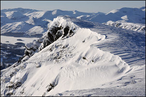
 half way along the Blencathra ridge |
The climb was worth it as the views to the south opened up to reveal a magnificent panorama. The wind was now much stronger and the temperature still hovered around -5degC so I had to keep moving. There were several walkers about but previous footsteps in the snow had been almost obliterated due to the wind. The main path line was now visible and I followed it to the summit of Hallsfell Top. Taking pictures was difficult due to the battering wind and taking my gloves off to operate the camera had to be done as quickly as possible due to the cold. |
|
I headed SW along the ridge with the magnificent snow cornices to my left and clear views ahead. Scotland was clearly visible across the Solway Firth to the NW. As I started my descent at Knowe Crags I found a bit of shelter from the wind. I sat in the snow to eat my sandwiches and look out on the wonderful views across to Clough Head and Derwentwater. The rest of the descent was still tricky due to deep powder snow but I managed to get down to the main path above Blease Farm. It was then a short walk back to the car at Threlkeld. |
 on the Blencathra Ridge |
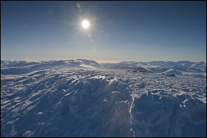
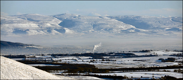 View from the climb of Scales Fell. In the distance you can just see the Great Dun Fell radar station which forms part of the air traffic control system for northern England and southern Scotland |
|
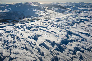
 wide view from the descent of Blease Fell |
|
|
|
|