|
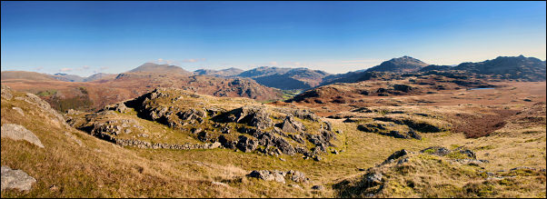
Birker Fell, Hartley Crag, Great
Whinscale, Great Worm Crag, Cumbria. |
|
|
SD 1886 9528 |
 Morning sun on Rough How |
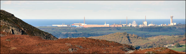 Sellafield from Sike Moss |
|
|
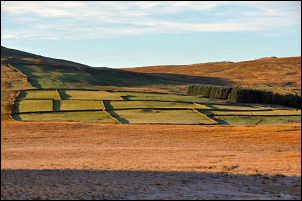
Further along the road a path heads north, out across the featureless Sike Moss. A post marked the way off the road but that was the last marker for a long time. A path is marked on the map but there is only a faint trace on the ground. As expected it was very wet but the sub zero overnight temperatures had frozen some parts making it easier to cross. I was heading for the buildings of Birkerthwaite but the last stretch of path shown on the map followed the west bank of Highford Beck. I could see that way would be a wellington and snorkel route so I crossed the beck and followed better ground below Scar Crag. The Birkerthwaite buildings seemed like a collection of private houses. A walled lane to the north headed out across a couple of fields, over Ellerbeck Bridge and on to another track to Whincop buildings. These looked like they were being renovated as lots of building materials and equipment were lying around. |
|
|
|
|
|
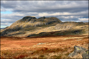
The path continued north but I left it at the first cross wall and turned right to head up a nice ridge to Hartley Crag. There is no marked path and no sign on the ground but underfoot it was good walking. The views down in to Eskdale were very impressive and all the way along the summit the views got better. They were also helped by the clear sunny weather. Up a short steep climb to Gate Crag I got even better views then a nice easy descent to the river above Birker Force. I crossed it and followed the well used path to Low Birker Tarn. |
 Crossing Low Birker Pool (beck) |
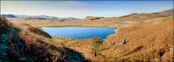 Low Birker Tarn |
|
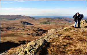 Crook Crag summit with the Isle of man on the distant horizon |
I followed it a short while longer but left it and turned left up steep and rough ground. I wanted to have a look on the summit of Great Whinscale and Crook Crag and in the absence of any visible path I had to make my own route through the bouldery climb. It seemed to take ages but was worth the effort. There ware some people already on the summit when I got there. Over the top I dropped down to a grassy flat stretch before the next haul up to Green Crag where more people were sitting enjoying the view. |
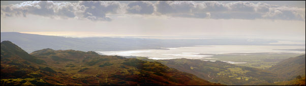 the Duddon Estuary from White How |
|
|
|
 view from White How with Devoke Water in the distance |
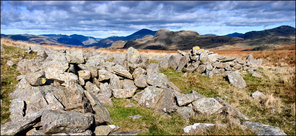 old stone shelters east of Great Worm Crag |
|
|
I had to retrace my steps down from the summit before heading south for White How then across open ground to Great Worm Crag. Apart from a couple of squelchy bits it was mostly firm underfoot and the walking improved greatly near the top. I could see the Birker Fell road below and descended on good ground to the ancient cairn shown on the map close to Rough Crag at SD 18795 96627. A path descended across Freeze Beck and back to the road at Winds Gate. A short way down and I was back at the car. |
|