|
Dunnerdale, Seathwaite, Harter
Fell, Ulpha Fell, Cumbria. |
|
|
SD 2126 9533 |
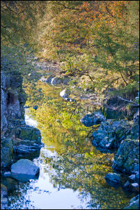 River Duddon from Birks Bridge |
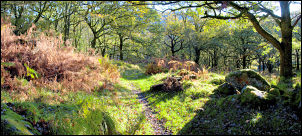 woodland path approaching Birks |
The bridge is of interesting construction as it has several holes built in to the parapet walls. Presumably there are to allow water to flow through at times of extreme flood and prevent the bridge being carried away. After crossing the River Duddon I followed a path up to the property of Birks. I sign on the door said it was an outdoors facility and owned by Grove School, Market Drayton, Shropshire. |
|
The access to The Birks headed up and to the right. I followed it then left to head up the steep fell side towards Harter Fell. A steep climb reduces in gradient at a gate then an area of good ground gives impressive views down into the valley. Just when I thought I’d done most of the climbing the tall rocky summit of Harter Fell loomed up ahead. I was now in pleasant sunshine but the wind was still cold and I needed my windproof on. |
 Birks |
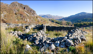 Sheepfold above Birks |
It was a bit early for lunch but when I got to the summit trig point I had to hang around for a while to take in the magnificent vista. Just to the south was a nice nook in the rocks which gave me shelter from the chill wind and also full views out to the Duddon estuary. |
|
To the west was the outline of the Isle of Man and I could just see Douglas 52 miles away and 40miles to the south was Blackpool Tower. It was a delightful spot to eat my sandwiches. I’d had the whole place to myself but as I descended to Spothow Gill I met two walkers coming up. I turned south to follow a very lumpy and wet in places path into Dunnedale Forest. |
 Harter Fell trig point |
 the view from my lunch stop on Harter Fell. |
|
|
Where the path meets a substantial forest road I left it to head down to Grassguards Gill. I left the footpath altogether, crossed the gill and wall and headed up on to Ulpha Fell towards Wormshell How. I was expecting wet and boggy ground but was pleased to find a faint path heading my way and not too wet either. Below the How the route became even better underfoot and generally followed a wall heading first south then towards the SW. Below the wall a whole series of parallel walls descended to towards the valley bottom. |
|
 view out across the Duddon Estuary |
|
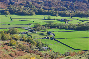 looking down to the River Duddon and Hall Bridge |
I continued to a point above Green How where I could cross the wall at and old wooden gate. The map shows a minor path but its route took me towards some very wet ground so I kept more to the west and managed to get through OK. Below Green How was a very interesting descent where it looked like motorbikes had been and made a terrible mess. I came to a stony track and followed it down to Nook which seemed to be a holiday home. Further on was another holiday home called Esp Hall which the map calls Esphole. I can see why they’ve changed the name. I was now back at the River Duddon and almost back at the car. It’s worth mentioning that this part of the river is called Mad Dog Dub on the 1:10K map. |
|
|
|