|
Buttermere, Low Crag, High
Stile, Red Pike, Scale Force, Cumbria. |
|
|
NY 1763 1704 |
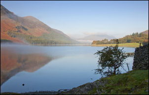 Buttermere |
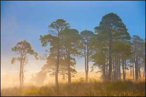 trees in Warnscale |
The sun was still low and still higher than the summit of Fleetwith Pike ahead. At Gatgesgarth Farm I turned right by the buildings, through a couple of gates and along the path towards Peggy’s Bridge. There was no sign of the campsite shown on the map. I stopped occasionally to admire the morning views across Buttermere and up in to Warnscale. Over the bridge the main path turned right to follow the lake side but I wanted to head diagonally up towards High Stile. There is a path shown on the map which is also visible up the hillside. For some unknown reason there was a wooden barrier across the path indicating it was closed. No sign was displayed so I just walked round it and headed upwards in the pleasant sunshine. |
|
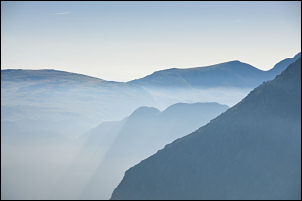
The path gave nice views across Buttermere and eventually Comb Beck where I was able to see up in to the impressive Burness Comb. Ahead I could see a lone walker coming up the path from Burtness Wood. As I started up the main path to High Stile I left it for a while to see if I could get a better view of Burtness Comb, but I couldn’t so re-joined the main path up. Following up the ridge is quite steep in places but does give extremely good views out across Buttermere and Crummock Water. Because of the exposure it must be the best ascent in the area. As I got higher the views became clearer and I could see that the Keswick area was still shrouded in mist while Skiddaw and Blencathra stood out crystal clear. |
 Grasmoor from High Stile |
 wide view from the climb of High Stile. L to R Grasmoor, Robinson & Fleetwith Pike with Buttermere in the valley. |
|
|
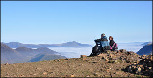
I reached a nice flat area on the approach to the summit and sat for a while to enjoy the views and my sandwiches. More people were about as they’d come up by the more traditional routes. There was now a sharp descent as I continued to Red Pike. I had a look at the small pond on the way but it was far too dirty to consider for a camp site water supply. Up on Red Pike more people were enjoying the sunshine and views. I didn’t stop but set off down another steep descent before reaching easier ground. I now had a choice of routes down to Scale Force but chose the path down Lingcomb Edge as it gives the best views. Crossing Blea Crag the path is very lumpy and narrow in places and it was a relief to reach the stone steps on the final descent to Scale Beck. I then turned right and followed the main path back towards Buttermere. |
|
 Fleetwith Pike from High Stile |
 GreenGable from High Stile |
 Red Pike with Blencathra in the distance |
 across Buttermere to Fleetwith Pike |
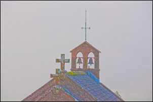 Crosses and bells on St James Chuch Buttermere |
The area of open grass and trees by the water’s edge was delight and I dawdled as I passed by to reached the ranger’s land-rover. I stopped briefly to chat with him about the changing weather and swap stories of views of Innominate Tarn on Haystacks. The village was full of people and many were waiting at the bus stop. As I set off up the road to my car the bus arrived. It was already over half full so I doubt there’ll be room for all those waiting. |
|
|
|