|
Greendale Tarn, Haycock, Scoat
Tarn, Low Tarn, Cumbria |
|
|
NY 1446 0563
|
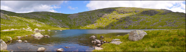
 Greendale Tarn from the north |
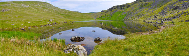 Greendale Tarn from the south |
|
|
The last time I came this way I’d followed the other side of the river and so missed walking by the tarn. I kept to the right and followed a very faint path round to the north side of the tarn. I now wanted to head for the Pots of Ashness but with no visible path I had to find the best route I could. Recent heavy rain had made most of the off-path fell very soggy and it was difficult finding a suitable route. I headed up the east side of Seatallan to find dryer ground then north towards Haycock. As I climbed the ground became dryer and thankfully the masses of horrible large flies became less frequent. By the time I reached the summit of Haycock the wind had increased a bit and there were no more flies. The views were excellent and it is one of those exceptional views where the coast can be seen to the west and turning the other way reveals the highest fells in Cumbria. |
|
 looking back to Haycock from the climb to Steeple |
|
 Great Gable |
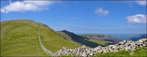
I sat behind the wall and enjoyed a leisurely sit down to eat my sandwiches. I then followed the magnificent sweep of fell and wall to the NE. If the weather is clear this is on of the fines stretches of path in Cumbria. The views change all the time with Sca Fell to the right and then the Great Gable which has a very curious profile from this direction. Over Steeple I headed towards Red Pike but before the summit turned right and headed down to Scoat Tarn.
|
|
|
|
|
This is another of those less visited tarns and is definitely worth a visit. Near the outlet is a rain gauge mounted on a pole. Over a slight raise I descended to low Tarn which also has great views and it is nice to see the familiar peaks from an unfamiliar viewpoint.
|
 Rain guage by Scoat Tarn |
 Cattle on Knott Ends |
I couldn’t find any sign of a path as I continued down along Brimfull Beck. At Knott Ends I looked down the rest of my descent to see it I could find a route with minimal deep ferns. |
|
About half way down I came to a large well built cairn which was much more substantial that those normally seen. It looked like a memorial of some kind but there was no plaque. It was a difficult route-finding exercise below but I eventually reached the road below Bowderdale.
|
 Cairn near Bowderdale |
|
|
|
|
|
As I’d expected the road was now very busy and all the parking places had cars in them and people sat nearby enjoying the sunshine. Approaching my car I saw a man sat on his bike by the wall and chatting to a farmer in the field. As I got closer I recognised him. He was Joss Naylor the famous fell runner who lives nearby. I stopped for a brief chat, took his photo, and then continued back to the car. |
|
|
|