|
Gayle (nr Hawes), Dodd Fell,
Wether Fell, Yorkshire. |
|
|
SD 8720 8929 |
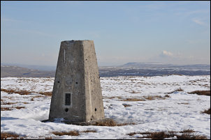 Trig point on Dodd Fell Hill |
 Ruin of Rock Edge Cottage |
Approaching Gaudy House the path leaves the track and follows the wall side up on to the fell. There was still a lot of drifted snow around and most of the gates had to be climbed over as they were snowed shut. I was still on the Pennine Way route and as I got higher the views were still good and I could see down into Snaizeholme Beck while up ahead Ingleborough came in to view. There was even more snow and not much clear ground to walk on. I was heading for the trig point on Dodd Fell Hill but the snow fields to my left were too steep to get up. By the time the gradient had eased I had to turn back on myself to climb up to the fell top. |
|
After checking out the trig point I tuned back to head for the West Cam Road track. After reaching it I continued to the gate then left it to follow the wall up to the ruin of Rock Edge Cottage which was partially buried in the snow. I continued along the wall until it turned left I continued straight on over snow to descend to the Cam High Road which is tarmac and had been cleared of snow. There was easy walking for a mile or so with nice views. |
 The Cam High Road. |
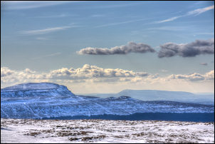 Pen-y-Ghent from the Cam High Road. |
I joined the Oughtershaw Road for a while then left it to continue along the Cam High Road track towards Wether Hill. The drifted snow between the walls made going difficult so at times I had to divert onto the fell adjacent. The path skirting the fell to the west was fairly difficult and lumpy in places but improved over the summit of Flint Hill. There were then new impressive views along Wensleydale. The deep set track descended towards Yorburgh where I came to flat ground for a while before leaving the main path to descend by a minor path across fields directly to Gayle. The views were good all the way down. |
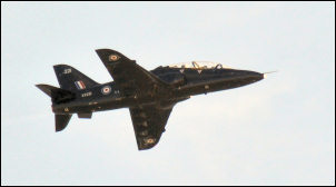 RAF training over the Cam Road |
|