|
Slaidburn, Hornby Road, White
Hill, Lamb Hill Fell, Jumbles Quarry, Bowland. |
|
|
SD 7116 5256. It was wet, windy and dark when I arrived in Slaidburn and the main car park was ‘pay and display’. There was another parking area by a children’s play area and several cars were already parked there so I put mine there as well. As I got my gear ready a little bit of light began to appear. As I set off walking I glanced back to see a sign which hadn’t been visible before in the dark. It said the parking area was for locals only and others may be clamped. I understand this in the height of summer but not now. I’m sure the parking area was paid for by the County Council and not the locals so that means I’ve part paid for it. I wasn’t going to take any chances so drove through the village to The Scaithe and left my car there. I walked back through the dark and wet village and headed up Shay Lane. There were a coupel of people out walking dogs but otherwise nobody. I continued up Shay Lane passing Ellerbeck Hall then turned right in to Wood House Lane. |
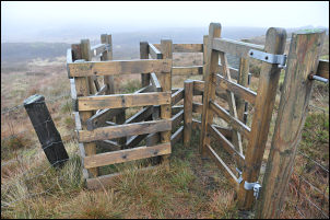 Confusion of gates on the fell top. |
 The survey tower |
There was a nice stone way marker at the junction but it was too dark and wet to take a photo. The lane twisted and turned until the final stretch which headed in a straight line to the end of the tarmac. Even where the adopted road ended the continuing track was in reasonable condition and there was evidence of concrete and steel reinforcing wires. He weather was still miserable and I thought I would soon be in cloud. As it turned out I didn’t. I continued up in the wind and rain until I reached the gate at the high point on the road. My next objective was the trig point on White Hill. The wire fence heading up onto the high moor seemed to be going in the right direction so I followed it. When I reached the summit plateau the cloud cleared enough for me to see the trig point and also the nearby sighting tower. I left the fence and crossed some boggy and unpleasant ground to reach the tower. I didn’t hang around as it was quite windy so then had a quick look at the trig point then back to the fence. I knew I could follow the fence to the road summit on the Lyth Fell road but that wasn’t where I wanted to be. I set of bravely across open and boggy ground in a ENE direction. |
|
Eventually Far Costy Clough came in to view and I started to descend to the river. The recent rain had caused the level to rise considerably and it took a lot of searching upstream to be able to jump across. Once over the descent was quite pleasant. I’d left the tussocky high moor behind and was mostly on grass with the occasional shooting butt along the way. My objective was the old Jumbles Quarry which was used for the building of the Stocks Reservoir dam. It was a pleasant surprise to see the old steam crane still in the quarry. It had been there since the early 1920s and was reasonably intact for its age. I was able to follow the old rail tracks for a while which used to carry the trains and wagons to the reservoir site further down the Hodder Valley. The easy going soon stopped when I reached the river again and I had to remove my boots to wade across. In the far bank iwas able to follow the old rail tracks as far as Cross of Greet bridge where I came to the road. The final few miles were south along the road back to Slaidburn. |
 The old steam crane in Jumbles Quarry |
|
|
|